|
| Mesoscale Discussion 2089 |
|
< Previous MD Next MD >
|
|
Mesoscale Discussion 2089
NWS Storm Prediction Center Norman OK
0754 PM CDT Thu Sep 19 2024
Areas affected...southeastern Minnesota...western Wisconsin
Concerning...Severe Thunderstorm Watch 677...
Valid 200054Z - 200245Z
CORRECTED FOR MISSPELLING
The severe weather threat for Severe Thunderstorm Watch 677
continues.
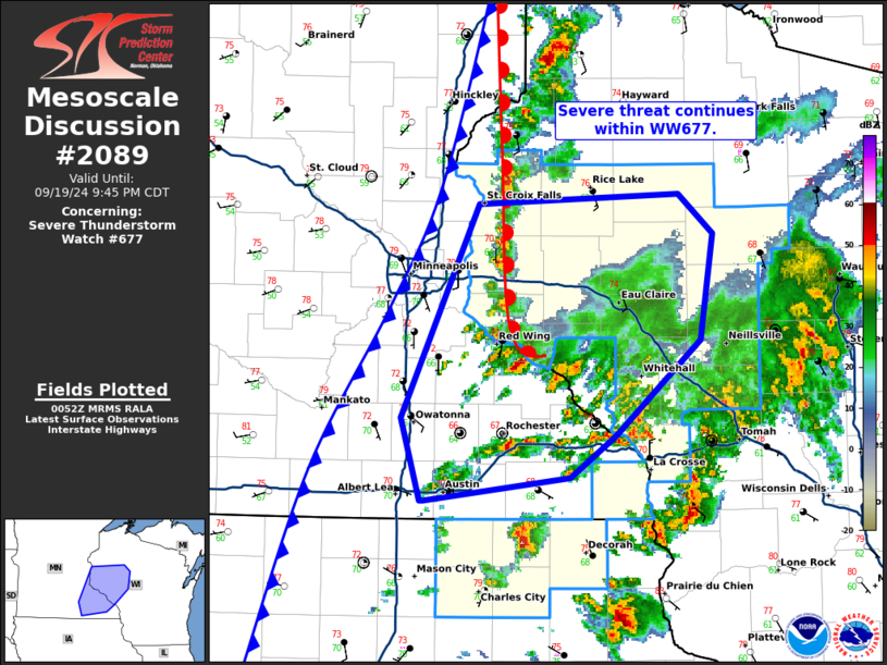
SUMMARY...Severe threat continues within WW677.
DISCUSSION...Storms continue along a northward lifting warm front
and cold front moving across portions of eastern MN into western WI.
Recent storm reports from storms along the warm front have produced
instances of hail up to 1.25 in. Recent 00z RAOB from MPX shows a
warm layer aloft with MLCAPE around 1900 J/kg and deep layer shear
around 30 kts. Hodographs are primarily linear with generally
uniformly westerly winds aloft. This will continue to support mixed
mode of multi-cell clusters and occasional supercells capable of
large hail. The highest threat for large hail will remain along and
north of the warm front in the near term. Further severe development
will continue along and ahead of the cold front as well, with
potential for hail and instances of strong to severe wind.
..Thornton/Hart.. 09/20/2024
...Please see www.spc.noaa.gov for graphic product...
ATTN...WFO...ARX...MPX...
LAT...LON 44119332 45409268 45469098 45219069 44589080 43999153
43759191 43609313 43609316 44119332
|
|
Top/All Mesoscale Discussions/Forecast Products/Home
|
|


 @NWSSPC