Bozle Creek
Paghimo ni bot Lsjbot. |
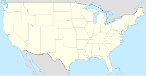
Suba ang Bozle Creek sa Tinipong Bansa.[1] Nahimutang ni sa kondado sa Dawes County ug estado sa Nebraska, sa sentro nga bahin sa nasod, 2,300 km sa kasadpan sa Washington, D.C. Ang Bozle Creek mao ang bahin sa tubig-saluran sa Mississippi River ang ulohan sa nasod.
| Bozle Creek | |
| Suba | |
| Nasod | |
|---|---|
| Estado | Nebraska |
| Kondado | Dawes County |
| Gitas-on | 1,120 m (3,675 ft) |
| Tiganos | 42°41′00″N 103°25′12″W / 42.6833°N 103.41992°W |
| Timezone | MST (UTC-7) |
| - summer (DST) | MDT (UTC-6) |
| GeoNames | 5693800 |
Ang mga gi basihan niini
usba- ↑ Bozle Creek sa Geonames.org (cc-by); post updated 2006-01-15; database download sa 2017-02-28
