Jump to content

161st meridian west: Difference between revisions

From Wikipedia, the free encyclopedia
Content deleted Content added
Added {{Unreferenced}} tag
 
Line 1: Line 1:
{{short description|Line of longitude}}
{{Unreferenced|date=January 2021}}
{{Location map-line|lon=-161}}
{{kml}}
{{kml}}

Latest revision as of 02:27, 7 January 2021

Line across the Earth
161°
161st meridian west

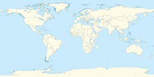
The meridian 161° west of Greenwich is a line of longitude that extends from the North Pole across the Arctic Ocean, North America, the Pacific Ocean, the Southern Ocean, and Antarctica to the South Pole.

The 161st meridian west forms a great circle with the 19th meridian east.

From Pole to Pole

[edit]

Starting at the North Pole and heading south to the South Pole, the 161st meridian west passes through:
Co-ordinates Country, territory or sea Notes
90°0′N 161°0′W / 90.000°N 161.000°W / 90.000; -161.000 (Arctic Ocean) Arctic Ocean
71°37′N 161°0′W / 71.617°N 161.000°W / 71.617; -161.000 (Chukchi Sea) Chukchi Sea
70°21′N 161°0′W / 70.350°N 161.000°W / 70.350; -161.000 (United States)  United States Alaska
64°51′N 161°0′W / 64.850°N 161.000°W / 64.850; -161.000 (Bering Sea) Bering Sea Norton Bay
64°33′N 161°0′W / 64.550°N 161.000°W / 64.550; -161.000 (United States)  United States Alaska
64°15′N 161°0′W / 64.250°N 161.000°W / 64.250; -161.000 (Bering Sea) Bering Sea Norton Sound - passing just east of Besboro Island, Alaska,  United States (at 64°7′N 161°17′W / 64.117°N 161.283°W / 64.117; -161.283 (Besboro Island))
63°37′N 161°0′W / 63.617°N 161.000°W / 63.617; -161.000 (United States)  United States Alaska — mainland and Hagemeister Island
58°33′N 161°0′W / 58.550°N 161.000°W / 58.550; -161.000 (Bering Sea) Bering Sea Bristol Bay
56°1′N 161°0′W / 56.017°N 161.000°W / 56.017; -161.000 (United States)  United States AlaskaKudobin Islands and Alaska Peninsula
55°26′N 161°0′W / 55.433°N 161.000°W / 55.433; -161.000 (Pacific Ocean) Pacific Ocean Passing just west of Unga Island, Alaska,  United States (at 55°19′N 160°51′W / 55.317°N 160.850°W / 55.317; -160.850 (Unga Island))
Passing just east of Rakahanga atoll,  Cook Islands (at 10°1′S 161°4′W / 10.017°S 161.067°W / -10.017; -161.067 (Rakahanga))
10°22′S 161°0′W / 10.367°S 161.000°W / -10.367; -161.000 (Cook Islands)  Cook Islands Manihiki atoll
10°26′S 161°0′W / 10.433°S 161.000°W / -10.433; -161.000 (Pacific Ocean) Pacific Ocean
60°0′S 161°0′W / 60.000°S 161.000°W / -60.000; -161.000 (Southern Ocean) Southern Ocean
78°2′S 161°0′W / 78.033°S 161.000°W / -78.033; -161.000 (Antarctica) Antarctica Ross Dependency, claimed by  New Zealand

See also

[edit]
pFad - Phonifier reborn

Pfad - The Proxy pFad of © 2024 Garber Painting. All rights reserved.

Note: This service is not intended for secure transactions such as banking, social media, email, or purchasing. Use at your own risk. We assume no liability whatsoever for broken pages.


Alternative Proxies:

Alternative Proxy

pFad Proxy

pFad v3 Proxy

pFad v4 Proxy