Alcalá de la Selva: Difference between revisions
Appearance
Content deleted Content added
m robot Adding: ru:Алькала-де-ла-Сельва |
m robot Adding: nl:Alcalá de la Selva |
||
| Line 65: | Line 65: | ||
[[es:Alcalá de la Selva]] |
[[es:Alcalá de la Selva]] |
||
[[it:Alcalá de la Selva]] |
[[it:Alcalá de la Selva]] |
||
[[nl:Alcalá de la Selva]] |
|||
[[pt:Alcalá de la Selva]] |
[[pt:Alcalá de la Selva]] |
||
[[ru:Алькала-де-ла-Сельва]] |
[[ru:Алькала-де-ла-Сельва]] |
||
Revision as of 16:42, 27 June 2008
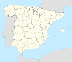
Alcalá de la Selva, Spain | |
|---|---|
 | |
| Country | Spain |
| Autonomous community | Aragon |
| Province | Teruel |
| Municipality | Alcalá de la Selva |
| Area | |
| • Total | 105 km2 (41 sq mi) |
| Population (2004) | |
| • Total | 523 |
| • Density | 5.0/km2 (13/sq mi) |
| Time zone | UTC+1 (CET) |
| • Summer (DST) | UTC+2 (CEST) |
Alcalá de la Selva is a municipality located in the province of Teruel, Aragon, Spain. According to the 2004 census (INE), the municipality has a population of 523 inhabitants.
Formerly a Moorish town known as Al-Qual' at, Alcalá de la Selva was regained by Alfonso II in 1170. Between 1835 and 1840, the town was occupied by the forces of Don Carlos troops during the First Carlist War.
