Druance: Difference between revisions
Appearance
Content deleted Content added
add natura 2000 |
progression Tags: Mobile edit Mobile web edit Advanced mobile edit |
||
| Line 7: | Line 7: | ||
| mouth = [[Noireau]] |
| mouth = [[Noireau]] |
||
| mouth_coordinates = {{coord|48|50|54.6|N|0|32|49.6|W|format=dms|display=inline,title}} |
| mouth_coordinates = {{coord|48|50|54.6|N|0|32|49.6|W|format=dms|display=inline,title}} |
||
| progression = |
| progression = [[Noireau]]→ {{ROrne}} |
||
| subdivision_type1 = Country |
| subdivision_type1 = Country |
||
| subdivision_name1 = France |
| subdivision_name1 = France |
||
| Line 19: | Line 19: | ||
The surrounding area of the river and its tributeries are a [[Natura 2000]] conservation area, called [[Bassin de la Druance]].<ref>{{Cite web |url=https://www.tourismeequestre-normandie.fr/wp-content/uploads/2024/01/cirkwi_CONDE-EN-NORMANDIE-Au-Fil-de-la-Druance-fr-383930.pdf| title=Au fil de la Druance |language=fr |publisher=www.calvados-tourisme.com }}</ref> |
The surrounding area of the river and its tributeries are a [[Natura 2000]] conservation area, called [[Bassin de la Druance]].<ref>{{Cite web |url=https://www.tourismeequestre-normandie.fr/wp-content/uploads/2024/01/cirkwi_CONDE-EN-NORMANDIE-Au-Fil-de-la-Druance-fr-383930.pdf| title=Au fil de la Druance |language=fr |publisher=www.calvados-tourisme.com }}</ref> |
||
==References== |
==References== |
||
Latest revision as of 18:16, 20 October 2024
| Druance | |
|---|---|
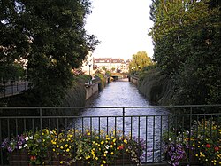
 The Druance flowing through Condé-sur-Noireau | |
| Location | |
| Country | France |
| Physical characteristics | |
| Source | |
| • location | Les Monts d'Aunay, Calvados |
| Mouth | Noireau |
• coordinates | 48°50′54.6″N 0°32′49.6″W / 48.848500°N 0.547111°W |
| Length | 31.24 km (19.41 mi) |
| Basin features | |
| Progression | Noireau→ Orne→ English Channel |
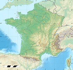
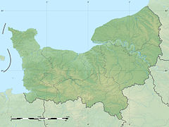
The Druance is a river in northwestern France, flowing through the department of Calvados. It is 31.24 km long.[1] Its source is in Les Monts d'Aunay, and it flows into the river Noireau in the commune of Condé-sur-Noireau and through Suisse Normande.[2] It flows through three other communes, Terres de Druance, Périgny & Pontécoulant all of which are in the area known as Suisse Normande.[1][3]
The surrounding area of the river and its tributeries are a Natura 2000 conservation area, called Bassin de la Druance.[4]
References
[edit]- ^ a b Sandre. "Fiche cours d'eau - Druance (I24-0420)".
- ^ "LA DRUANCE ET SES PRINCIPAUX AFFLUENTS (Identifiant national : 250020048)" (PDF). ZNIEFF.
- ^ "Map of Suisse Normande" (PDF).
- ^ "Au fil de la Druance" (PDF) (in French). www.calvados-tourisme.com.

