Tuxtilla: Difference between revisions
Appearance
Content deleted Content added
m Added 1 {{Bare URL inline}} tag(s) using a script. For other recently-tagged pages with bare URLs, see Category:Articles with bare URLs for citations from August 2024 |
m v2.05b - Bot T20 CW#61 - Fix errors for CW project (Reference before punctuation) |
||
| (One intermediate revision by one other user not shown) | |||
| Line 98: | Line 98: | ||
}} |
}} |
||
'''Tuxtilla''' is a [[Municipalities of Veracruz|municipality]] located in the south zone in the [[List of states of Mexico|Mexican state]] of [[Veracruz]]<ref>https://www.google.com/maps/place//@18.233333,-95.133333,12z/data=!5m1!1e4?hl=en&entry=ttu |
'''Tuxtilla''' is a [[Municipalities of Veracruz|municipality]] located in the south zone in the [[List of states of Mexico|Mexican state]] of [[Veracruz]],<ref>{{cite web | url=https://www.google.com/maps/place//@18.233333,-95.133333,12z/data=!5m1!1e4?hl=en&entry=ttu | title=Google Maps }}</ref> about 175 km from the state capital [[Xalapa]]. It has a surface of 168.62 km2. It is located at {{coord|18|14|N|95|8|W|}}. The name comes from the language Náhuatl, Tuz-Tlan. |
||
==Geography== |
==Geography== |
||
Latest revision as of 06:22, 28 August 2024
This article needs additional citations for verification. (April 2018) |
Tuxtilla | |
|---|---|
Municipality and town | |
| Coordinates: 18°14′N 95°8′W / 18.233°N 95.133°W | |
| Country | |
| State | Veracruz |
| Region | Papaloapan |
| Municipality | Tuxtilla |
| Area | |
| • Total | 168.62 km2 (65.10 sq mi) |
| Population (2005) | |
| • Total | 2,126 |
| Time zone | UTC-6 (Central Standard Time) |
| • Summer (DST) | UTC-5 (Central Daylight Time) |
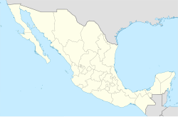
Tuxtilla is a municipality located in the south zone in the Mexican state of Veracruz,[1] about 175 km from the state capital Xalapa. It has a surface of 168.62 km2. It is located at 18°14′N 95°8′W / 18.233°N 95.133°W. The name comes from the language Náhuatl, Tuz-Tlan.
Geography
[edit]Tuxtilla is bounded by Cosamaloapan to the north, Chacaltianguis to the east and the state of Oaxaca to the south.
The weather in Tuxtilla is very warm and wet all year with rains in summer and autumn.
Agriculture
[edit]It produces principally maize, beans, mango and sugarcane.
Celebrations
[edit]In May, the municipality hosts a celebration to honor San Isidro Labrador, Patron of the town. In December, the town holds a celebration to honor the Virgen de Guadalupe.
References
[edit]
External links
[edit]- (in Spanish) Municipal Official webpage
- (in Spanish) Municipal Official Information
