Bangarh
Aerial view of Bangarh, Gangarampur | |
| Alternative name | Devkot, Kotivarsha, Devikota, Devakota, Diw-kot |
|---|---|
| Location | Gangarampur, West Bengal, India |
| Coordinates | 25°24′45″N 88°31′50″E / 25.41250°N 88.53056°E |
| Type | settlement |
| History | |
| Founded | Earlier than 200 BC |
Bangarh is an ancient city situated in Gangarampur, West Bengal, India. Bangarh was the ancient city which was the administrative centre of Kotivarsha Vishaya (territorial division), itself part of the wider administrative unit of Pundravardhana Bhukti, which had Mahasthangarh as its capital[1] in the period of Chandras, Varmans and Senas. After the Senas were defeated by the Muslims under Muhammad Bakhtiyar Khalji, Devkot was established as their capital where Muhammad Bakhtiyar Khalji died.[2][full citation needed]
Names
[edit]The 12th-century writer Hemachandra wrote that the names Koṭivarṣa, Bāṇapura, Devīkoṭa, Umāvana, and Śoṇitapura all referred to the same place. A similar list was provided by Puruṣottama, except he had Uṣāvana instead of Umāvana. Bāṇapura is the apparent ancestor of the present name Bangarh; the place is supposed to be connected with the mythical king Bāṇa. The fort at Bangarh is also called "Damdamaḥ" in recent times.[3]: 216
Geography
[edit]
10miles
M: municipal city/ town, CT: census town, R: rural/ urban centre, H: historical site
Owing to space constraints in the small map, the actual locations in a larger map may vary slightly
Location
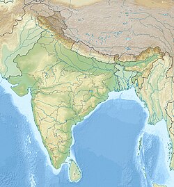
[edit]Bangarh is located at 25°24′45″N 88°31′50″E / 25.41250°N 88.53056°E
In the map alongside, all places marked on the map are linked in the full screen version.
History
[edit]The earliest mentions about the Kotivarsha town are found in the Vayu Purana (XXIII,209) and the Brihat Samhita (XI, II). Lexicographers, Hemchandra (the Abhidhanachintamani IV,977) and Purushottama (in his Trikandashesha) have mentioned the city by several names – Uma(Usha?)vana, Banapura. Sandhyakara Nandi in his Ramacharita described at length about the temples and the lakes of the city.[4] The ruins of the city are found in Bangarh, which is located at Gangarampur city, about 45 km south of Balurghat city, in Dakshin Dinajpur district of West Bengal state in eastern India. There was a Buddhist monastery at Devikota.[5]
Muslim rule was first established in Bengal in 1204 by Muhammad Bakhtiyar Khalji. The kingdom was called Lakhnawati or Lakhnauti. The capital was located sometimes at Lakhnawati and sometimes at Devkot.[citation needed] Bakhtiyar Khalji died at Devkot in 1205–06, possibly murdered by Ali Mardan Khalji, who was governor of Naran-Koh.[6]
Debīkoṭ was listed in the Ain-i-Akbari as a mahal in sarkar Lakhnauti (the name is spelled "Dihikoṭ" or "Dehīkoṭ" in extant copies of the Ain).[3]: 216 [7]: 43 The mahal of Debīkoṭ was listed with an assessed revenue of 31,624 dams.[8]: 131 It was also the seat of a juwār (subdivision between a sarkar and a mahal) including 6 other mahals, although none of the others have been located.[7]: 43
Excavations at Bangarh
[edit]The earliest excavations at Bangarh was carried out by a team led by K.G. Goswami during 1938–41. Located on the bank of the Punarbhaba, the excavated site reflects its urban character. The site has its core in the form of a citadel surrounded by mud ramparts (area about 25 hectares) which dates from the earliest phase of the site. The earliest phase remains uncertain, as the excavations could not reach the natural soil.[1] The citadel area revealed five cultural phases dating from the time of the Mauryas to the medieval period. The initial phase (the Mauryan period) indicates that the city had a modest beginning in which it had probably a mud rampart wall. It was only in the following phase (the Kushana period, 200 BCE - 300 CE) a brick built wide rampart wall is found with drains, cesspits and residential buildings made of burnt bricks of a very large size, showing distinct signs of prosperity and burgeoning urbanism. The excavated materials of the Gupta period are not comparable with the richness and diversity of those belonging to Kushana cultural phase. Though the late Gupta phase of Bangarh is marked by decadence, particularly in terms of building activities, the Pala period (mid 8th century -12th century), in sharp contrast, indicates a picture of efflorescence. Rampart walls, compound walls, residential quarters, temples with ambulatory path and its enclosing walls, damp proof granaries, bathrooms, drains and ring wells suggest a prosperous condition of the city.[9]

References
[edit]- ^ a b Chakrabarti, Dilip K. (2006, reprint 2007). Relating History to the Land in Patrick Oleville (ed.) Between the Empires: Society in India 300 BCE to 400 CE, New York: Oxford University Press, ISBN 0-19-568935-6, p.9
- ^ Ali, Muhammad Mohar. History of the Muslims of Bengal. Riyadh: Imam Muhammad Ibn Saʿūd Islamic University. OCLC 1075660077.
- ^ a b Sharma, Tej Ram (1978). Personal and Geographical Names in the Gupta Inscriptions. Delhi: Concept Publishing Company. Retrieved 8 March 2024.
- ^ Roy, Niharranjan (1993). Bangalir Itihas: Adiparba (in Bengali), Calcutta: Dey's Publishing, ISBN 81-7079-270-3, p.301
- ^ Majumdar, Dr. R.C., p. 457
- ^ Majumdar, R.C. (1973). History of Mediaeval Bengal. Calcutta: G. Bharadway. p. 3. OCLC 942846162..
- ^ a b Habib, Irfan (1982). An Atlas of the Mughal Empire. Oxford University Press. ISBN 0195603796. Retrieved 26 March 2023.
- ^ Abu'l-Fazl ibn Mubarak (1891). The Ain-i-Akbari. Translated by Jarrett, Henry Sullivan. Calcutta: Asiatic Society of Bengal. Retrieved 21 January 2021.
- ^ "Eight eras of Indian history unearthed in Bangarh". The Telegraph. Calcutta. 14 May 2009. Archived from the original on 12 September 2012. Retrieved 23 September 2009.
External links
[edit] Balurghat travel guide from Wikivoyage

