Tank (city)
Tank
| |
|---|---|
| Coordinates: 32°08′N 70°14′E / 32.13°N 70.23°E | |
| Country | Pakistan |
| Province | Khyber Pakhtunkhwa |
| District | Tank District |
| Area | |
• Total | 1,679 km2 (648 sq mi) |
| Elevation | 261 m (856 ft) |
| Population (2023 census) | |
• Total | 49,172 |
| Time zone | UTC+5 (PST) |
| Number of towns | 1 |
| Number of Union Councils | 16 |
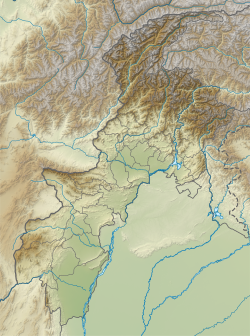
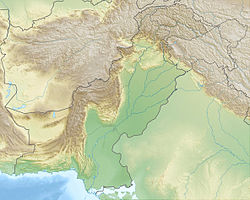
Tank (Pashto: ټانک / ټاک; Urdu: ٹانک; Saraiki: ٹاک) is the capital city of Tank District, Khyber Pakhtunkhwa, Pakistan. The city is located northwest of Dera Ismail Khan, and southeast of Jandola, Tank Subdivision (formerly known as "Frontier Region Tank").[1] Lakki Marwat and Bannu lies to the northeast while South Waziristan lies to the west.
Climate
[edit]The climate in Tank is referred to as a local steppe climate. There is little rainfall throughout the year. This location is classified as BSh by Köppen and Geiger. The average annual temperature in Tank is 24.1 °C | 75.4 °F. The annual rainfall is 539 mm | 21.2 inch. The temperatures are highest on average in June, at around 34.5 °C | 94.2 °F. The lowest average temperatures in the year occur in January, when it is around 11.9 °C | 53.4 °F.[2]
Demographics
[edit]The population of city in 1972 was 14,306 but according to the 2023 Census of Pakistan, the population has risen to 49,172.[3]
| Census | Population |
|---|---|
| 1972 | 14,306 |
| 1981 | 25,003 |
| 1998 | 35,741 |
| 2017 | 47,064 |
| 2023 | 49,172 |
Language
[edit]Pashto and Saraiki (locally called Hinko) are the two languages spoken in Tank. The vast majority of people are conversant in the Pashto language as majority of the population consists of Pakhtun or Pashtun tribes. English is also understood by the educated.
Location
[edit]
It is at 32º13' N. and 70º32' E[4] and is to the northwest of the Indus River and close to the Takht-i-Sulaiman Range.
Localities
[edit]The city was previously inside a fort. Here Sir Henry Durand, lieutenant-governor of the Punjab, was killed in 1870 when passing on an elephant under a gateway.[5]
References
[edit]- ^ JUI-F facing tough competition in NA-25 - Daily Times Pakistan
- ^ "Tank climate: Weather Tank & temperature by month".
- ^ "Tānk (Tank, Khyber Pakhtunkhwa, Pakistan) - Population Statistics, Charts, Map, Location, Weather and Web Information". www.citypopulation.de. Retrieved 5 September 2024.
- ^ Tank Town - Imperial Gazetteer of India, v. 23, p. 245.
- ^ One or more of the preceding sentences incorporates text from a publication now in the public domain: Chisholm, Hugh, ed. (1911). "Tonk". Encyclopædia Britannica. Vol. 27 (11th ed.). Cambridge University Press. p. 10.

