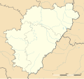
Bestand:Charente department location map.svg
Uiterlijk

Afmetingen van deze voorvertoning van het type PNG van dit SVG-bestand: 634 × 600 pixels Andere resoluties: 254 × 240 pixels | 507 × 480 pixels | 812 × 768 pixels | 1.082 × 1.024 pixels | 2.165 × 2.048 pixels | 1.095 × 1.036 pixels.
Oorspronkelijk bestand (SVG-bestand, nominaal 1.095 × 1.036 pixels, bestandsgrootte: 184 kB)
Bestandsgeschiedenis
Klik op een datum/tijd om het bestand te zien zoals het destijds was.
| Datum/tijd | Miniatuur | Afmetingen | Gebruiker | Opmerking | |
|---|---|---|---|---|---|
| huidige versie | 15 okt 2008 17:03 |  | 1.095 × 1.036 (184 kB) | Sting | == Summary == {{Location|45|39|45|N|00|15|00|E|scale:1000000}} <br/> {{Information |Description={{en|Blank administrative map of the department of Charente, France, for geo-location purpose, with distinct boundaries for regions, departmen |
Bestandsgebruik
Meer dan 100 pagina's gebruiken dit bestand. De volgende lijst geeft alleen de eerste 100 pagina's weer die dit bestand gebruiken. Er is ook een volledige lijst beschikbaar.
- Abzac (Charente)
- Agris (Frankrijk)
- Aigre (gemeente)
- Alloue
- Ambernac
- Ambérac
- Angeac-Champagne
- Angeac-Charente
- Angeduc
- Angoulême (stad)
- Ansac-sur-Vienne
- Ars (Charente)
- Asnières-sur-Nouère
- Aubeterre-sur-Dronne
- Aubeville
- Baignes-Sainte-Radegonde
- Barbezières
- Bardenac
- Bassac (Frankrijk)
- Bazac
- Beaulieu-sur-Sonnette
- Bellon
- Benest
- Bernac (Charente)
- Bessac
- Bessé
- Bignac
- Bioussac
- Birac (Charente)
- Boisbreteau
- Bonnes (Charente)
- Bonneuil (Charente)
- Bourg-Charente
- Bouteville
- Boutiers-Saint-Trojan
- Bouëx
- Brettes
- Brie-sous-Barbezieux
- Brigueuil
- Brillac
- Brossac
- Bréville (Charente)
- Bunzac
- Bécheresse
- Cellefrouin
- Cellettes (Charente)
- Chabanais
- Chabrac
- Chadurie
- Challignac
- Champagne-Mouton
- Champniers (Charente)
- Chantillac
- Charmant
- Charmé
- Charras
- Chassenon
- Chassiecq
- Chassors
- Chavenat
- Chazelles (Charente)
- Chirac (Charente)
- Châteauneuf-sur-Charente
- Claix (Charente)
- Coulonges (Charente)
- Fleurac (Charente)
- Juillé (Charente)
- La Chapelle (Charente)
- La Rochette (Charente)
- Laprade (Charente)
- Le Bouchage (Charente)
- Ligné (Charente)
- Mareuil (Charente)
- Marsac (Charente)
- Montjean (Charente)
- Mouzon (Charente)
- Mérignac (Charente)
- Oradour (Charente)
- Orival (Charente)
- Pérignac (Charente)
- Reignac (Charente)
- Rivières (Charente)
- Rouffiac (Charente)
- Rouillac (Charente)
- Roussines (Charente)
- Ruffec (Charente)
- Saint-Avit (Charente)
- Saint-Brice (Charente)
- Saint-Front (Charente)
- Saint-Georges (Charente)
- Saint-Laurent-des-Combes (Charente)
- Saint-Saturnin (Charente)
- Saint-Simon (Charente)
- Saint-Sornin (Charente)
- Saint-Vallier (Charente)
- Segonzac (Charente)
- Sers (Charente)
- Souvigné (Charente)
- Valence (Charente)
- Vars (Charente)
Meer koppelingen naar dit bestand bekijken.
Globaal bestandsgebruik
De volgende andere wiki's gebruiken dit bestand:
- Gebruikt op als.wikipedia.org
- Gebruikt op ar.wikipedia.org
- Gebruikt op ceb.wikipedia.org
- Gebruikt op cy.wikipedia.org
- Gebruikt op de.wikipedia.org
- Wikipedia:Kartenwerkstatt/Positionskarten/Europa
- Vorlage:Positionskarte Frankreich Charente
- Stade Camille-Lebon
- Roc-de-Sers
- Militärflugplatz Cognac-Châteaubernard
- Grotte du Placard
- Grotte de Montgaudier
- Grotte de Fontéchevade
- Grotte du Visage
- Abri du Bois-du-Roc
- Grottes du Quéroy
- Grotte d’Artenac
- Grotte des Perrats
- Gebruikt op el.wikipedia.org
- Gebruikt op en.wikipedia.org
- Gebruikt op eo.wikipedia.org
- La Rochefoucauld (Charente)
- Jarnac
- Ŝablono:Situo sur mapo Francio Charente
- Angoulême (stacidomo)
- Cognac (stacidomo)
- Ruffec (stacidomo)
- Chabanais (stacidomo)
- La Rochefoucauld (stacidomo)
- La Rochefoucauld-en-Angoumois
- Jarnac (stacidomo)
- Mainxe-Gondeville
- Gondeville
- Châteauneuf-sur-Charente (stacidomo)
- Châteauneuf-sur-Charente
- Chalais (stacidomo)
- Chalais (Charente)
- Montmoreau (stacidomo)
- Saint-Amant-de-Montmoreau
- Montmoreau
- Luxé (stacidomo)
- Ruelle (stacidomo)
- Ruelle-sur-Touvre
- Chasseneuil-sur-Bonnieure (stacidomo)
- Roumazières-Loubert (stacidomo)
- Roumazières-Loubert
- Exideuil-sur-Vienne (stacidomo)
- Saillat - Chassenon (stacidomo)
- Gond-Pontouvre
- Saint-Michel-sur-Charente (stacidomo)
Globaal gebruik van dit bestand bekijken.

