برکمستد
ظاهر
| Berkhamsted | |
|---|---|
| Town | |
Berkhamsted. From Top to bottom: Berkhamsted Old Town Hall, St Peter's Church, Berkhamsted Castle, Ashridge, Berkhamsted Totem Pole, Berkhamsted High Street. | |
 Coat of Arms | |
| جمعیت | ۱۸٬۵۰۰ (mid-2016 est.)[۱] |
| OS grid reference | SP993077 |
| District | |
| Shire county | |
| Region | |
| اؤلکه | England |
| موستقیل دوولت | United Kingdom |
| Post town | BERKHAMSTED |
| Postcode district | HP4 |
| تیلفون کودو | 01442 |
| Ambulance | East of England |
| UK Parliament | |
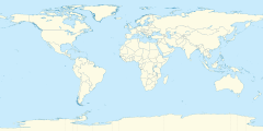
برکمستد (اینگیلیسیجه: Berkhamsted) بریتانیادا بیر یاشاییش منطقهسیدیر سوْن نۆفوس تخمینلرینه گؤره 18500 نفر دیر. بۇ شهر اینگیلیس اؤلکهسینده یئرلشیب.
گؤرونتولر
[دَییشدیر]بیرده باخ
[دَییشدیر]قایناقلار
[دَییشدیر]- ^ Community Profiles - Summary Profile Selection: Berkhamsted Geo-type: Large Settlements A to B. The Hertfordshire Local Information System (HertsLIS). Community Information and Intelligence Unit, Hertfordshire County Council. یوْخلانیلیب26 November 2017.[دائمی اولو باغلانتیلی]
| بو شهرلر ایله باغلی مقاله، بیر قارالاما مقاله دیر. بونو گئنیشلندیرمکله ویکیپدیایا کؤمک ائده بیلرسینیز. |


