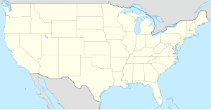
Pawnee County (kondado sa Tinipong Bansa, Kansas)
- Alang sa ubang mga dapit sa mao gihapon nga ngalan, tan-awa ang Pawnee County.
| Pawnee County (Comté de Pawnee) | |
| Condado de Pawnee | |
| Kondado | |
| Nasod | |
|---|---|
| Estado | Kansas |
| Gitas-on | 621 m (2,037 ft) |
| Tiganos | 38°10′53″N 99°14′12″W / 38.18133°N 99.23673°W |
| Capital | Larned |
| Area | 1,954.00 km2 (754 sq mi) |
| Population | 6,973 (2013-03-07) [1] |
| Density | 4 / km2 (10 / sq mi) |
| Timezone | CST (UTC-6) |
| - summer (DST) | CDT (UTC-5) |
| GeoNames | 4277045 |
Kondado ang Pawnee County (Prinanses: Comté de Pawnee, Kinatsila: Condado de Pawnee) sa Tinipong Bansa.[1] Nahimutang ni sa estado sa Kansas, sa sentro nga bahin sa nasod, 1,900 km sa kasadpan sa Washington, D.C. Adunay 6,973 ka molupyo.[1] Naglangkob kin og 1,954 ka kilometro kwadrado. Pawnee County mopakigbahin sa usa ka utlanan sa Rush County, Edwards County, Barton County, Stafford County, Ness County, ug Hodgeman County ang ulohan sa nasod.
Ang yuta sa Pawnee County kay patag.[saysay 1]
Pawnee County may sa mosunod nga mga subdibisyon:
Mga lungsod sa Pawnee County:
Sa mosunod nga mga natural nga mga bahin makita sa Pawnee County:
- Ash Creek (suba)
- Buckner Creek (suba)
- Cocklebur Creek (suba)
- Hubbard Creek (suba)
- James Lake (tubiganan)
- Jenkins Hill (bukid)
- Pawnee River (suba)
- Pickle Creek (suba)
- Sawmill Creek (suba)
Ang klima klima sa kontinente.[3] Ang kasarangang giiniton 15 °C. Ang kinainitan nga bulan Hulyo, sa 30 °C, ug ang kinabugnawan Pebrero, sa 0 °C.[4] Ang kasarangang pag-ulan 716 milimetro matag tuig. Ang kinabasaan nga bulan Hunyo, sa 146 milimetro nga ulan, ug ang kinaugahan Enero, sa 11 milimetro.[5]
| ||||||||||||||||||||||||||||||||||||||||||||||||||||||||||||||||||||||||||||||||||||||||||||||||||||||||||||||||||||||||||||
Saysay
[usba | usba ang wikitext]- ↑ Kalkulado gikan sa gitas-on data (DEM 3") gikan sa Viewfinder Panoramas.[2] Ang bug-os nga algoritmo anaa dinhi.
Ang mga gi basihan niini
[usba | usba ang wikitext]- ↑ 1.0 1.1 1.2 Pawnee County sa Geonames.org (cc-by); post updated 2013-03-07; database download sa 2017-02-28
- ↑ "Viewfinder Panoramas Digital elevation Model". 2015-06-21.
- ↑ Peel, M C; Finlayson, B L. "Updated world map of the Köppen-Geiger climate classification". Hydrology and Earth System Sciences. 11: 1633–1644. doi:10.5194/hess-11-1633-2007. Retrieved 30 Enero 2016.
{{cite journal}}: CS1 maint: unflagged free DOI (link) - ↑ 4.0 4.1 "NASA Earth Observations Data Set Index". NASA. Retrieved 30 Enero 2016.
- ↑ "NASA Earth Observations: Rainfall (1 month - TRMM)". NASA/Tropical Rainfall Monitoring Mission. Retrieved 30 Enero 2016.
Gikan sa gawas nga tinubdan
[usba | usba ang wikitext]| Aduna'y mga payl ang Wikimedia Commons nga may kalabotan sa artikulong: Pawnee County. |


