Category:Spanish-language maps
Jump to navigation
Jump to search
- Please place all maps with legends and annotations in Spanish in this category.
Subcategories
This category has the following 24 subcategories, out of 24 total.
*
- Spanish-language geological maps (10 F)
C
K
- Kyōkai Senjō no Horizon maps (2 F)
L
M
- Map of Juan de la Cosa (38 F)
O
- Obando map of Tomares (11 F)
P
- Plano de Olavide de Sevilla (17 F)
S
Media in category "Spanish-language maps"
The following 200 files are in this category, out of 870 total.
(previous page) (next page)-
 "Spanish" Word Varieties.png 451 × 599; 76 KB
-
 1708. Partido de Villena.jpg 727 × 599; 196 KB
-
 1753 plano ciudad de México.jpg 1,000 × 1,242; 482 KB
-

-
 1775 volcan Pacaya Guatemala.jpg 977 × 1,404; 327 KB
-
 1778 plano de Tierra Firme.jpg 3,669 × 2,833; 1.74 MB
-
 1785 López mapa Tierra Firme detalle provincia del Darién.jpg 1,848 × 1,018; 542 KB
-
 1785 López mapa Tierra Firme.jpg 4,750 × 2,238; 1.84 MB
-
 1792 Spanish map of the Holy Land by Juan Peñalver.jpg 9,361 × 6,692; 7.86 MB
-
 1794 mapa incendio Nueva Orleans AGI.jpg 2,096 × 1,530; 559 KB
-

-

-

-

-

-

-
 1920 map of Spanish Morocco.jpg 11,634 × 8,165; 16.82 MB
-
 1930s transport map of Germany in Italian (cropped).jpg 12,054 × 8,295; 18.09 MB
-
 2010 mundial euro grupos.PNG 880 × 472; 26 KB
-
 2024 Saxony state election in Spanish.svg 2,190 × 1,055; 683 KB
-
 2024 Thuringian state election in Spanish.svg 2,190 × 1,055; 1.1 MB
-
 349px-Muchas Karelias.png 349 × 599; 176 KB
-
 778px-Zaragoza - Mapa SUPERIFICIE municipal svg.png 571 × 386; 70 KB
-
 800px-Tresgargantas.png 800 × 344; 37 KB
-
 A four-colour map of the Red Sea with names in Spanish.svg 220 × 282; 1.65 MB
-
 Accesos de Alboraya.png 832 × 662; 103 KB
-
 ACUÍFERO SAHARA SEPTENTRIONAL.jpg 1,429 × 981; 1.74 MB
-
 Acuífero Sahara Septentrional.jpg 1,164 × 781; 1.18 MB
-
 Aegean Sea map bathymetry-es.png 2,500 × 3,040; 8.49 MB
-
 Afluentes del Guadiana.png 1,142 × 555; 184 KB
-
 Agosto Septiembre 1936.png 459 × 380; 19 KB
-
 Agricultura ganaderia europa.png 1,242 × 1,535; 328 KB
-
 AlboInterior.jpg 352 × 599; 57 KB
-
 Alcalá de Henares (s. XVI y XVII) plano con los edificios principales.png 1,822 × 1,301; 3.68 MB
-
 Universidad de Alcalá (RPS 25-11-2017) Campus Científico-tecnológico, cartel.png 2,224 × 1,627; 5.35 MB
-

-
 Alcalá de Henares (1938-1939) mapa topográfico 560 del Ejército del Centro - EM.png 5,079 × 6,578; 38.87 MB
-
 Alcalá de Henares (20-07-1837) croquis de Pedro Ortiz de Pinedo.png 4,893 × 3,340; 20.93 MB
-
 Alcalá de Henares (20-10-1802) plano topográfico del Soto de Aldovea.png 7,649 × 4,891; 62.07 MB
-
 Alcalá de Henares (2011) Corredor Eco Fluvial del río Henares.png 727 × 493; 626 KB
-
 Alcalá de Henares (2024) mapa del término municipal.png 1,183 × 684; 176 KB
-

-
 Alcalá de Henares (RPS 07-03-2020) Parque de los Cerros, mapa.png 2,607 × 2,289; 5 MB
-
 Alcalá de Henares (RPS 24-06-2018) Barrios durante la Edad Media, plano.png 1,278 × 681; 904 KB
-
 Alcalá de Henares (RPS 27-03-2016) Parque de Los Cerros, mapa.png 2,127 × 1,919; 3.34 MB
-
 Alcalá de Henares, casco histórico, calle Mayor.png 1,007 × 751; 149 KB
-
 Alcaudete (Jaén).PNG 452 × 422; 21 KB
-
 Alcornocalesmapa.jpg 1,000 × 1,428; 196 KB
-
 Alejandro-Bertrand.jpg 4,570 × 3,386; 1.96 MB
-
 Alemania - Eden Del Turista - verso.jpg 19,573 × 13,960; 46.02 MB
-
 Alemania - Paraiso Del Turista.jpg 21,178 × 13,719; 49.65 MB
-
 Alfa Karina Arrué en Dingboche.png 756 × 582; 854 KB
-
 Algeciras paisaje.jpg 1,680 × 2,082; 405 KB
-
 Algeria map-es.jpg 280 × 301; 24 KB
-
 AlgunasIslasAlSurDelCanalBeagle.png 429 × 363; 66 KB
-
 AlgunasIslasAlSurDelCanalBeagleConLímite.png 429 × 363; 44 KB
-
 AlgunasIslasASurDelCanalBeagle.jpg 650 × 652; 92 KB
-
 Almoravid Empire.png 327 × 537; 64 KB
-
 AlolaMapa.png 2,340 × 1,500; 176 KB
-
 Americanmap.jpg 2,550 × 3,300; 979 KB
-
 Andalucia flora.png 3,000 × 2,064; 342 KB
-
 Andalucia pisos climáticos.png 3,000 × 2,064; 565 KB
-
 Andalucía av sc 200901.png 2,000 × 1,400; 193 KB
-
 Andalucía av scp 200902.png 1,800 × 1,200; 193 KB
-
 Andalucía av scp 200904.png 1,800 × 1,200; 165 KB
-
 Andalucía av scpe 200901.png 2,000 × 1,400; 209 KB
-
 Andalucía ceceante y seseante.PNG 591 × 400; 119 KB
-
 Andalucía Oriental (Provincias).png 800 × 480; 50 KB
-
 Andorra mapa.png 330 × 355; 7 KB
-
 Annobón Bioko-es.png 1,895 × 1,098; 495 KB
-
 Annobón-es.png 890 × 991; 166 KB
-

-
 Antofagasta 1895, entre Rio Loa y 24°S.jpg 3,676 × 2,312; 2.91 MB
-

-
 Antoine-Remy Frémin, Carta del Mediodia de la Judea ó Tierra-Santa (FL36566995 3906531).jpg 4,238 × 2,956; 7.46 MB
-

-
 Antoine-Remy Frémin, Carta del Reino de Herodes (FL36567094 3906568).jpg 2,487 × 3,026; 3.98 MB
-

-

-

-

-

-
 Antártida.png 400 × 400; 37 KB
-
 Ar-map-es.png 341 × 732; 34 KB
-
 Area metropo Bahia Cadiz y Jerez.jpg 567 × 540; 106 KB
-
 Areas protegidas de la cuenca hidrografica de panama.jpg 1,000 × 824; 261 KB
-
 Argentina - Husos horarios.png 568 × 937; 116 KB
-
 Argentina - Husos horarios1.png 568 × 937; 116 KB
-
 Argentina - Map - Provinces with names.png 456 × 776; 37 KB
-
 Argentina - Político (regiones).png 568 × 937; 23 KB
-
 Argentina - Político 2.png 568 × 937; 25 KB
-
 Argentina IDH.png 582 × 995; 277 KB
-
 Argentinecartographiebeaglechannel.png 472 × 343; 31 KB
-
 Asturiasdesantillana.jpg 512 × 333; 116 KB
-
 Atenas clásica.png 990 × 744; 213 KB
-
 Atlas catalan de 1375 01 (FL169300244 0982468).jpg 12,631 × 15,712; 286.27 MB
-
 Atlas catalan de 1375 02 (FL169300245 0982468).jpg 12,564 × 15,753; 230.46 MB
-
 Atlas catalan de 1375 03 (FL169300246 0982468).jpg 12,741 × 16,258; 241.81 MB
-
 Atlas catalan de 1375 04 (FL169300247 0982468).jpg 12,691 × 15,678; 228.15 MB
-
 Atlas catalan de 1375 05 (FL169300248 0982468).jpg 12,578 × 15,793; 249.13 MB
-
 Atlas catalan de 1375 06 (FL169300249 0982468).jpg 12,578 × 15,720; 251.37 MB
-
 Atomic bomb 1945 mission map es.svg 1,919 × 2,525; 390 KB
-
 Austria map es.png 330 × 355; 18 KB
-
 Autopistaesp ap7.png 467 × 394; 35 KB
-
 AVE-Diciembre2006.png 1,024 × 768; 176 KB
-
 Azerbaijan districts numbered spanish.png 750 × 595; 191 KB
-
 Bahía Algeciras.jpg 1,565 × 2,330; 1.03 MB
-
 Bahía de Campeche Cart Siglo XVI.jpg 1,157 × 1,001; 356 KB
-
 Balboa Voyage 1513.PNG 581 × 316; 48 KB
-
 Baleares-rotulado.png 1,013 × 636; 293 KB
-
 Banda Oriental in 1783.png 444 × 511; 78 KB
-
 Banyeres de Mariola.png 852 × 675; 123 KB
-
 Barents sp.png 655 × 599; 170 KB
-
 Barranco del Dulce.jpg 525 × 525; 96 KB
-
 Baselines chile.png 1,653 × 1,787; 894 KB
-
 Batalla de Lochem-Hugo Cañete-La Guerra de Frisia.jpg 1,728 × 865; 1.86 MB
-
 Batalla de Noordhom -Hugo Cañete-La Guerra de Frisia.jpg 1,722 × 862; 1.5 MB
-
 Beagle1984.png 728 × 488; 118 KB
-
 Benidorm 1859.png 1,292 × 1,286; 170 KB
-

-

-

-
 Biar.png 661 × 471; 65 KB
-
 Bioko-es.png 1,370 × 1,098; 335 KB
-
 Bucarest 1926.JPG 1,980 × 1,444; 640 KB
-
 Bulgaria1344-1396-es.png 582 × 599; 180 KB
-
 Bunkers en los alrededores de la bahía de Algeciras.jpg 500 × 712; 83 KB
-
 Cabodehornos.es.png 645 × 503; 164 KB
-
 Calamianes.jpg 2,379 × 2,575; 2.75 MB
-
 CampañaRumana1944.jpg 1,280 × 990; 940 KB
-
 Canada-usa.png 774 × 422; 129 KB
-
 CanalSevillaBonanza.png 1,551 × 361; 121 KB
-
 Canarias-rotulado.png 1,522 × 576; 360 KB
-
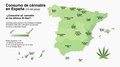 Cannabis en España 15-64.pdf 6,335 × 3,520; 840 KB
-
 Capitanía general de Filipinas.svg 494 × 243; 200 KB
-
 Carretera Austral.png 1,100 × 2,136; 884 KB
-
 Carreteraesp n232.png 467 × 394; 26 KB
-
 Carreteraesp n325.png 778 × 413; 91 KB
-
 Carta corográfica de la Gran Colombia 1825.jpg 7,400 × 5,904; 14.71 MB
-
 Carta de la República de Gran Colombia.jpg 10,423 × 8,615; 17.79 MB
-

-
 Castellano-Español-es.png 521 × 692; 47 KB
-
 Castellano-Español-nl.png 694 × 922; 33 KB
-
 Castiglione Map.png 2,820 × 866; 3.65 MB
-
 Castillo de la Atalaya; de 1800~.jpg 1,488 × 1,424; 343 KB
-
 Castillo de Salvatierra.jpg 2,891 × 1,232; 156 KB
-
 Castillo, Antonio del (Friar), Hierusalem (FL6879527 2369727).jpg 2,400 × 2,563; 2.3 MB
-
 Castillo, Antonio del (Friar), Hierusalem (FL6880512 2369726).jpg 1,960 × 3,163; 2.42 MB
-
 Castillo, Antonio del (Friar), Iaffa (FL6879010 2370363).jpg 1,749 × 1,851; 1.55 MB
-
 Castillo, Antonio del (Friar), Mons Olivarum S (FL147393103 2370365).jpg 4,801 × 3,285; 14.09 MB
-
 Castillo, Antonio del (Friar), Ramma (FL59321051 2370364).jpg 3,633 × 5,091; 26.29 MB
-
 Castros con defensas chevaux-de-frise.jpg 688 × 400; 81 KB
-
 Catalunya+Comarques+Español.jpg 1,152 × 1,150; 673 KB
-
 Caxcania map1.png 1,219 × 753; 204 KB
-
 Cañadas reales y ayuntamientos.png 794 × 1,122; 93 KB
-

-
 Central Asia borders esp.png 326 × 240; 7 KB
-
 Centrales nucleares España.png 685 × 570; 147 KB
-
 Centros de acción sobre España.png 640 × 514; 8 KB
-
 Ceuta (neutral).PNG 1,993 × 1,038; 383 KB
-
 Chile-Perú, Punto Concordia.jpg 918 × 882; 132 KB
-
 China vs Taiwan, global struggle for recognition.png 2,767 × 1,980; 175 KB
-
 ChironectesMinimusMAD.png 798 × 953; 38 KB
-
 Cicloton enero.jpg 792 × 483; 285 KB
-
 Ciudad Universitaria de Cisneros (Juan de Ovando 1564) plano de 1768.png 2,401 × 3,137; 16.69 MB
-
 Ciudades de la provincia de Valencia.png 511 × 535; 108 KB
-
 Ciudades de más de un millón de habitantes en la Federación Rusa en 2017.svg 1,052 × 744; 288 KB
-
 Civilizacion etrusca.png 1,488 × 1,808; 479 KB
-
 Cl-triconti.png 1,673 × 2,273; 1.57 MB
-
 Clima andalucía.png 850 × 509; 539 KB
-
 Clima Castilla-La Mancha.jpg 1,673 × 1,000; 240 KB
-
 Clima de Europa - Mapa tipo Köppen.png 826 × 866; 187 KB
-
 Climas de Castile-La Mancha.jpg 569 × 282; 28 KB
-
 Climas de España.png 2,690 × 1,943; 1.37 MB
-
 Climates of Spain (Climas de España).png 2,690 × 1,943; 1.34 MB
-
 Colombia (regiones naturales).png 300 × 397; 21 KB
-
 Colonia Agricola Santa Maria - 1, Acervo do Museu Paulista da USP.jpg 7,216 × 5,412; 21.38 MB
-
 Colonia de Santa Eulalia.png 763 × 644; 90 KB
-
 Colonization 1945 Spanish script.png 800 × 370; 68 KB
-
 Comarca de Alcalá de Henares (IGN 2013) mapa compuesto con los MTN50 535 y 560.jpg 5,959 × 8,775; 23.69 MB
-
 Comarca forestal 1 de la Comunidad de Madrid (2007) Parque Natural de Peñalara, mapa.png 1,587 × 2,293; 870 KB
-

-
 Comarca forestal 11 de la Comunidad de Madrid (2007) Robledo de Chavela, mapa.png 1,617 × 2,297; 593 KB
-
 Comarca forestal 12 de la Comunidad de Madrid (2007) El Escorial, mapa.png 1,618 × 2,307; 688 KB
-

-

-

-
 Comarca forestal 2 de la Comunidad de Madrid (2007) Lozoya, mapa.png 1,600 × 2,296; 782 KB
-
 Comarca forestal 3 de la Comunidad de Madrid (2007) Buitrago, mapa.png 1,615 × 2,297; 953 KB
-
 Comarca forestal 4 de la Comunidad de Madrid (2007) Montejo, mapa.png 1,617 × 2,299; 1.13 MB
-
 Comarca forestal 5 de la Comunidad de Madrid (2007) Torrelaguna, mapa.png 1,611 × 2,311; 776 KB
-
 Comarca forestal 6 de la Comunidad de Madrid (2007) Alcalá de Henares, mapa.png 1,617 × 2,306; 802 KB
-
 Comarca forestal 7 de la Comunidad de Madrid (2007) Este, mapa.png 1,620 × 2,307; 915 KB
-

-

-
 Comarcas de la Comunidad de Madrid.png 480 × 363; 34 KB
-
 Comarcas de Málaga-Junta de Andalucia.PNG 778 × 413; 30 KB
-
 Comarcas forestales de la Comunidad de Madrid (2007) distribución geográfica, mapa.png 1,622 × 1,772; 694 KB
-
 Comarcas Mancha.png 514 × 339; 31 KB
-
 Comarcas R Murcia Atlas digital.png 608 × 638; 53 KB


