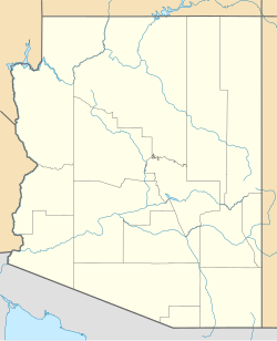
Cortaro is a neighborhood of Marana, Arizona[2] in Pima County, Arizona, United States. Cortaro is located along Interstate 10 13 miles (21 km) northwest of Tucson. Cortaro has a post office with ZIP code 85652.[3]
Cortaro, Arizona | |
|---|---|
| Coordinates: 32°21′22″N 111°05′18″W / 32.35611°N 111.08833°W | |
| Country | United States |
| State | Arizona |
| County | Pima |
| Elevation | 2,159 ft (658 m) |
| Time zone | UTC-7 (Mountain (MST)) |
| ZIP code | 85742 |
| Area code | 520 |
| GNIS feature ID | 24384[1] |
Climate
editClimate type is characterized by extremely variable temperature conditions. The Köppen Climate Classification sub-type for this climate is "Bsh" (Mid-Latitude Steppe and Desert Climate).[4]
| Climate data for Cortaro, Arizona | |||||||||||||
|---|---|---|---|---|---|---|---|---|---|---|---|---|---|
| Month | Jan | Feb | Mar | Apr | May | Jun | Jul | Aug | Sep | Oct | Nov | Dec | Year |
| Mean daily maximum °C (°F) | 19 (67) |
22 (71) |
24 (76) |
29 (85) |
34 (94) |
39 (103) |
39 (103) |
38 (100) |
37 (98) |
31 (88) |
24 (76) |
20 (68) |
11 (51) |
| Mean daily minimum °C (°F) | 1 (34) |
3 (37) |
5 (41) |
8 (47) |
12 (54) |
19 (66) |
23 (73) |
22 (71) |
18 (65) |
12 (53) |
6 (42) |
2 (35) |
11 (51) |
| Average precipitation mm (inches) | 18 (0.7) |
20 (0.8) |
20 (0.8) |
10 (0.4) |
2.5 (0.1) |
7.6 (0.3) |
58 (2.3) |
53 (2.1) |
28 (1.1) |
23 (0.9) |
18 (0.7) |
28 (1.1) |
280 (11.2) |
| Source: Weatherbase [5] | |||||||||||||
References
edit- ^ U.S. Geological Survey Geographic Names Information System: Cortaro, Arizona
- ^ "Cortaro Marana, AZ 85743, Neighborhood Profile - NeighborhoodScout".
- ^ ZIP Code Lookup Archived June 15, 2011, at the Wayback Machine
- ^ Climate Summary for Cortaro, Arizona
- ^ "Weatherbase.com". Weatherbase. 2013. Retrieved on July 30, 2013.

