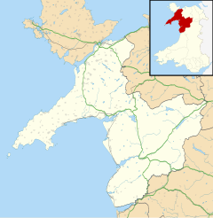
Glasinfryn is a small village in Gwynedd, Wales.[1][2] It is situated between the village of Tregarth and the city of Bangor, Gwynedd, and in the community of Pentir. The village is residential in nature but with many outlying farms.
| Glasinfryn | |
|---|---|
 High Street, Glasinfryn | |
Location within Gwynedd | |
| OS grid reference | SH585687 |
| Community | |
| Principal area | |
| Country | Wales |
| Sovereign state | United Kingdom |
| Post town | BANGOR |
| Postcode district | LL57 |
| Dialling code | 01248 |
| Police | North Wales |
| Fire | North Wales |
| Ambulance | Welsh |
| UK Parliament | |
| Senedd Cymru – Welsh Parliament | |
It is noted for having two bridges: one carries the old Bethesda to Bangor railway trackbed on an attractive Victorian architecture viaduct; the other is a concrete flyover built in the 1980s carrying the A55.
It is credited as the start of the A4244 road, but in reality the road lies approximately 1 kilometre (0.62 mi) south of the village. "Infryn" means turf, therefore the name of the village means literally "blue/green turf".
References
edit- ^ Ordnance Survey: Landranger map sheet 115 Snowdon (Caernarfon) (Map). Ordnance Survey. 2013. ISBN 9780319231845.
- ^ "Ordnance Survey: 1:50,000 Scale Gazetteer" (csv (download)). www.ordnancesurvey.co.uk. Ordnance Survey. 1 January 2016. Retrieved 18 February 2016.
External links
editWikimedia Commons has media related to Glasinfryn.
