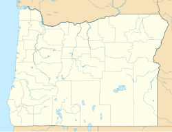
Olene is an unincorporated community in Klamath County, Oregon, United States.[1] It is 10 miles (16 km) southeast of Klamath Falls on Oregon Route 140.[2] Olene currently has a general store and at one time it had a school.[3][4][5] In 1940 Olene had a population of 62 and was considered a suburb of Klamath Falls.[6] Olene was the center of a prosperous dairy and potato farming district.[6]
Olene, Oregon | |
|---|---|
| Coordinates: 42°10′19″N 121°37′51″W / 42.17194°N 121.63083°W | |
| Country | United States |
| State | Oregon |
| County | Klamath |
| Elevation | 4,153 ft (1,266 m) |
| Time zone | UTC-8 (Pacific (PST)) |
| • Summer (DST) | UTC-7 (PDT) |
| GNIS feature ID | 1124978[1] |
| Coordinates and elevation from Geographic Names Information System[1] | |
According to William Gladstone Steel, Olene is a Klamath word meaning "eddy place" or "place of drift." O. C. Applegate adopted the word for the site in 1884 when the post office was established.[7] The original Olene post office was up the Lost River from the current townsite.[7] When the post office closed in 1966, it was near The Gap, a restriction in the Lost River.[7][8] This gap is also known as Olene Gap, and the Olene Hot Springs are nearby.[9][10]
The community was along a rail line operated jointly by Southern Pacific and Burlington Northern. Today the OC&E Woods Line State Trail, a rails to trails conversion, passes through Olene.[11] Originally built by the Oregon, California and Eastern Railway, the railroad line reached Olene in 1918.[9]
A geothermal drilling project near Olene was completed in early 2013, and the temperature produced by that well was in excess of 280 °F (138 °C).[12] Plans include drilling two or three more wells for a commercial-scale power plant, with a planned electrical capacity of 21 MWe.[12]
References
edit- ^ a b c "Olene". Geographic Names Information System. United States Geological Survey. November 28, 1980. Retrieved January 16, 2017.
- ^ Oregon Atlas & Gazetteer (7th ed.). Yarmouth, Maine: DeLorme. 2008. p. 70. ISBN 0-89933-347-8.
- ^ "Parking and Access". Klamath Rails-to-Trail Group. Retrieved December 13, 2010.
- ^ "Itineraries". Klamath Visitor & Convention Bureau. Retrieved December 13, 2010.
- ^ Tonsfeldt, Ward (August 1990). "Historical Resource Survey: Klamath County, Oregon" (PDF). Oregon Parks and Recreation Department. Retrieved December 13, 2010.
- ^ a b Writers' Program of the Work Projects Administration in the State of Oregon (1940). Oregon: End of the Trail. American Guide Series. Portland, Oregon: Binfords & Mort. p. 440. OCLC 4874569.
- ^ a b c McArthur, Lewis A.; McArthur, Lewis L. (2003) [1928]. Oregon Geographic Names (7th ed.). Portland, Oregon: Oregon Historical Society Press. p. 720. ISBN 978-0875952772.
- ^ "The Gap". Geographic Names Information System. United States Geological Survey, United States Department of the Interior. November 28, 1980. Retrieved December 13, 2010.
- ^ a b "OC&E Woods Line State Trail". Explore!. December 5, 2010. Retrieved December 13, 2010.
- ^ "Olene Hot Springs". Geographic Names Information System. United States Geological Survey, United States Department of the Interior. May 22, 1986. Retrieved December 13, 2010.
- ^ "OC&E Woods Line State Trail". Klamath Rails-to-Trail Group. Retrieved December 13, 2010.
- ^ a b [1] "Second Geothermal Well in the Works in Olene Area". Global Geothermal News. Retrieved October 14, 2013.
External links
edit

