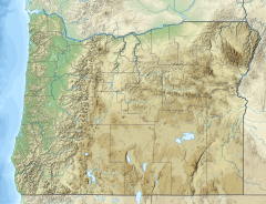
Pueblo Mountain is the highest mountain of the Pueblo Mountains mountain range, at 8,632 feet (2,631 m) in elevation.[2] It is located in Harney County in southeastern Oregon, within the Great Basin region of the western United States. It is about 7.4 miles (11.9 km) north of the community of Denio on the Nevada border and about 37.3 miles (60.0 km) south of Steens Mountain.
| Pueblo Mountain | |
|---|---|
Pueblo Mountain, as seen from south of Fields | |
| Highest point | |
| Elevation | 8,639 ft (2,633 m) NAVD 88[1] |
| Prominence | 3,032 ft (924 m)[2] |
| Coordinates | 42°05′58″N 118°39′02″W / 42.099465133°N 118.650553492°W[1] |
| Geography | |
| Location | Harney County, Oregon, U.S. |
| Parent range | Pueblo Mountains |
| Topo map | USGS Van Horn Basin |
References
edit- ^ a b "Pueblo". NGS Data Sheet. National Geodetic Survey, National Oceanic and Atmospheric Administration, United States Department of Commerce. Retrieved April 28, 2016.
- ^ a b "Pueblo Mountain, Oregon". Peakbagger.com. Retrieved April 22, 2009.
External links
edit- "Pueblo Mountain". SummitPost.org.
- "Pueblo Mountain". Geographic Names Information System. United States Geological Survey, United States Department of the Interior.
