Jump to content

Kozmadombja

Coordinates: 46°46′04″N 16°33′11″E / 46.76767°N 16.55305°E / 46.76767; 16.55305
From Wikipedia, the free encyclopedia

This is the current revision of this page, as edited by Ser Amantio di Nicolao (talk | contribs) at 22:12, 2 April 2020 (→‎External links: add authority control). The present address (URL) is a permanent link to this version.

(diff) ← Previous revision | Latest revision (diff) | Newer revision → (diff)
Kozmadombja
Village
Flag of Kozmadombja
Coat of arms of Kozmadombja
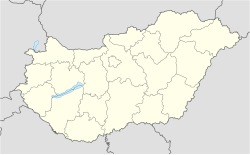
Kozmadombja is located in Hungary
Kozmadombja
Kozmadombja
Location of Kozmadombja
Coordinates: 46°46′04″N 16°33′11″E / 46.76767°N 16.55305°E / 46.76767; 16.55305
CountryHungary
RegionWestern Transdanubia
CountyZala
DistrictLenti
Area
 • Total7.63 km2 (2.95 sq mi)
Population
 (1 January 2024)[1]
 • Total34
 • Density4.5/km2 (12/sq mi)
Time zoneUTC+1 (CET)
 • Summer (DST)UTC+2 (CEST)
Postal code
8988
Area code(+36) 92
Websitekozmadombja.hu

Kozmadombja is a village in Zala County, Hungary.

References

[edit]
  1. ^ Detailed Gazetteer of Hungary. 23 September 2024 https://www.ksh.hu/apps/hntr.telepules?p_lang=EN&p_id=13082. Retrieved 23 September 2024. {{cite web}}: Missing or empty |title= (help)
[edit]


pFad - Phonifier reborn

Pfad - The Proxy pFad of © 2024 Garber Painting. All rights reserved.

Note: This service is not intended for secure transactions such as banking, social media, email, or purchasing. Use at your own risk. We assume no liability whatsoever for broken pages.


Alternative Proxies:

Alternative Proxy

pFad Proxy

pFad v3 Proxy

pFad v4 Proxy