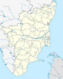
Oomachikulam
Oomachikulam | |
|---|---|
| Coordinates: 9°59′39″N 78°08′45″E / 9.994200°N 78.145800°E | |
| Country | |
| State | |
| District | Madurai district |
| Elevation | 172 m (564 ft) |
| Languages | |
| • Official | Tamil, English |
| Time zone | UTC+5:30 (IST) |
| Telephone Code | +91452xxxxxxx |
| Other Neighborhoods | Madurai, Sellur, Narimedu, Chinna Chokkikulam, B B Kulam, Simmakkal, Tallakulam, Goripalayam, Shenoy Nagar, Yanaikkal, Nelpettai, East Gate, Thathaneri, Koodal Nagar, K. Pudur and Arappalayam |
| Municipal body | Madurai Municipal Corporation |
| LS | Madurai Lok Sabha constituency |
| MP | S. Venkatesan |
| Website | https://madurai.nic.in |
Oomachikulam is a neighbourhood in Madurai district of Tamil Nadu state in the peninsular India.[1][2][3][4][5]
Oomachikulam is located at an altitude of about 172 ,m above the mean sea level with the geographical coordinates of 9°59′39″N 78°08′45″E / 9.994200°N 78.145800°E.[6]
From Tallakulam area of Madurai district to Natham area of Dindigul district, a four-lane road of 35 km long, is planned to be constructed at a cost of Rs.1,028 crore. As one phase of the project, a bridge of length 7.5 km from Tallakulam to Oomachikulam has been constructed at a cost of ₹612 crore.[7] Also, bridges are being constructed to connect Madurai to Thuvarankurichi area of Tiruchirappalli district via Natham. As a part of this, the works of beautifying the banks of Oomachikulam tank is also going on.[8] The bridge at Oomachikulam area has an elevated corridor.[9] Also, as there are many centre medians at short intervals on this highway, it is considered that accidents are likely to occur.[10] This four-lane road is known to be the longest road in Tamil Nadu and shortens the travel distance considerably.[11]
References
[edit]- ^ Staff Reporter (11 November 2019). "Oomachikulam residents allege police torture, extortion". The Hindu. Retrieved 13 February 2023.
- ^ India (Republic) Office of the Registrar General (1969). Census of India, 1961. Manager of Publications.
- ^ India Office of the Registrar (1962). Census of India, 1961. Manager of Publications.
- ^ Tamil Nadu Electricity Board (1964). Administration Report.
- ^ Criminal Justice India Series. Allied Publishers. 2002. ISBN 978-81-7764-519-4.
- ^ "GeoHack - Oomachikulam". geohack.toolforge.org. Retrieved 15 February 2023.
- ^ "மதுரையில் "பிரம்மாண்டம்"- 7.5 கிமீ.. ரூ.612 கோடி! தமிழ்நாட்டின் நீளமான மேம்பாலம் விரைவில் திறப்பு". Retrieved 13 February 2023.
- ^ "Elevated corridor linking Madurai, Tiruchy to be unveiled in January". The New Indian Express. Retrieved 13 February 2023.
- ^ Staff Reporter (11 November 2019). "Oomachikulam residents allege police torture, extortion". The Hindu. Retrieved 13 February 2023.
- ^ "மதுரை புதுநத்தம் சாலையில் 'சென்டர் மீடியம் கேப்'-களை குறைக்க கோரிக்கை - விபத்துகள் அதிகரிப்பதாகப் புகார்". Hindu Tamil Thisai (in Tamil). Retrieved 13 February 2023.
- ^ "தமிழகத்திலேயே மிக நீளமான மதுரை - நத்தம் பறக்கும் பால கட்டுமானப் பணி 95% நிறைவு". Hindu Tamil Thisai (in Tamil). Retrieved 13 February 2023.
