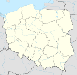
Łacha, Masovian Voivodeship
Appearance
Łacha | |
|---|---|
Village | |
| Coordinates: 52°32′32″N 21°5′34″E / 52.54222°N 21.09278°E | |
| Country | |
| Voivodeship | Masovian |
| County | Legionowo |
| Gmina | Serock |
Łacha [ˈwaxa] is a village in the administrative district of Gmina Serock, within Legionowo County, Masovian Voivodeship, in east-central Poland.[1] It lies approximately 5 kilometres (3 mi) north of Serock, 21 km (13 mi) north-east of Legionowo, and 38 km (24 mi) north of Warsaw.
Lacha was primarily a village of ethnic Germans before World War 2.[2]
References
[edit]- ^ "Central Statistical Office (GUS) - TERYT (National Register of Territorial Land Apportionment Journal)" (in Polish). 2008-06-01.
- ^ Abraham, Edward (2016). When I Was A Boy. Blurb. ISBN 9781367472518. Retrieved 31 August 2017.

