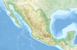
1911 Michoacán earthquake
 | |
| UTC time | 1911-06-07 11:02:50 |
|---|---|
| ISC event | 16958148 |
| USGS-ANSS | ComCat |
| Local date | June 7, 1911 |
| Local time | 04:26 |
| Magnitude | 7.6 Mw |
| Depth | 33 km[1] |
| Epicenter | 17°30′N 102°30′W / 17.5°N 102.5°W[2] |
| Areas affected | Mexico |
| Casualties | 45 dead |
The 1911 Michoacán earthquake occurred on June 7 at 04:26 local time (11:02 UTC).[3][4] The epicenter was located near the coast of Michoacán, Mexico. The earthquake had a magnitude of 7.6 on the moment magnitude scale.[5] 45 people were reported dead.[6] In Mexico City, 119 houses were destroyed.[7] Cracks were reported in Palacio Nacional, Escuela Normal para Maestros, Escuela Preparatoria, Inspección de Policía, and Instituto Geológico.[8] Ciudad Guzmán, the seat of Zapotlán el Grande, Jalisco, suffered great damage.[9]
The earthquake occurred hours before the revolutionary Francisco I. Madero entered Mexico City on the same day, and it was also known as "temblor maderista".
On June 7, 2011, a ceremony was held in Ciudad Guzmán commemorating the centenary of this earthquake.[10]
This earthquake was a megathrust earthquake along the Middle America Trench, a major subduction zone.[11]
See also
[edit]References
[edit]- ^ "CIEN AÑOS DE SISMICIDAD EN MEXICO, IGF UNAM, SSN". usuarios.geofisica.unam.mx. Retrieved 21 July 2016.
- ^ National Geophysical Data Center. "Comments for the Significant Earthquake". Retrieved 21 August 2011.
- ^ Notimex (2011-06-08). "Cumplió Cruz Roja 100 años de su primer servicio en Jalisco". sdpnoticias.com. Archived from the original on 2011-10-07. Retrieved 2011-08-21.
- ^ SEGOB - DGTI. "INEHRM - Secretaría de Educación Pública". Archived from the original on 2011-10-04. Retrieved 21 July 2016.
- ^ Engdahl, E. R.; Vallaseñor, A. (2002). "Global seismicity: 1900–1999" (PDF). International Handbook of Earthquake & Engineering Seismology. Part A, Volume 81A (First ed.). Academic Press. p. 703. ISBN 978-0124406520. Archived from the original (PDF) on 2017-08-20. Retrieved 2017-12-11.
- ^ "Apendice A, Historia de la Sismologia en Mexico". secre.ssn.unam.mx. Archived from the original on 2012-03-24. Retrieved 2011-08-21.
- ^ "Caracteristicas del sismo del 19 de septiembre de 1985". secre.ssn.unam.mx. Archived from the original on 2013-05-15. Retrieved 2011-08-21.
- ^ "Dos siglos de temblores". ssn.unam.mx. Archived from the original on 2008-02-03. Retrieved 2011-08-21.
- ^ "Enciclopedia de los Municipios de México, estado de jalisco, Zapotlán el Grande". Instituto Nacional para el Federalismo y el Desarrollo Municipal, Gobierno del Estado de Jalisco. Archived from the original on 2007-09-30. Retrieved 2011-08-21.
- ^ "Cd. Guzmán - En Zapotlán celebran centenario de fuerte terremoto de 1911". periodicoelsur.com. Archived from the original on 20 September 2016. Retrieved 21 July 2016.
- ^ Kostoglodov, Vladimir; Ponce, Lautaro (1994-01-10). "Relationship between subduction and seismicity in the Mexican part of the Middle America trench" (PDF). Journal of Geophysical Research. 99 (B1): 729–742.
External links
[edit]- The International Seismological Centre has a bibliography and/or authoritative data for this event.
