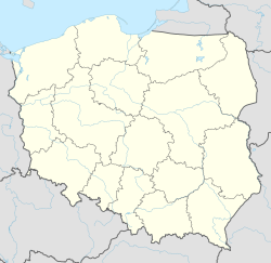
Aleksiejówka
Appearance
Aleksiejówka | |
|---|---|
Village | |
| Coordinates: 54°2′47.72″N 23°22′16.25″E / 54.0465889°N 23.3711806°E | |
| Country | |
| Voivodeship | Podlaskie |
| County | Sejny |
| Gmina | Giby |
| Population | 25[1] |
| Postal code | 16-506 [2] |
| Car plates | BSE |
Aleksiejówka ([alɛkɕɛˈjufka]; Lithuanian: Aleksėjauka) is a village in the administrative district of Gmina Giby, within Sejny County, Podlaskie Voivodeship, in north-eastern Poland, close to the borders with Belarus and Lithuania.[3]
History
[edit]From the 13th century to 1795, this village belonged to the Grand Duchy of Lithuania's Trakai Voivodeship.
In 1880 it was numbered at 13 people and 2 homes.[4]
In the interwar period, a lime kiln operated here by Świsłowskiego and Koncewicza.[5]
References
[edit]- ^ "Population of Aleksiejowka village". Retrieved 2021-11-04.
- ^ "Official list of post codes" (PDF). October 2013. p. 4. Archived from the original (PDF) on 2014-02-22.
- ^ "Central Statistical Office (GUS) - TERYT (National Register of Territorial Land Apportionment Journal)" (in Polish). 2008-06-01.
- ^ "Aleksiejówka (województwo podlaskie)" (in Polish). Warsaw. 1880. p. 29.
- ^ "The 1929 Polish Business Directory Project". Retrieved 2017-04-07.
