Jump to content

Ankaratra

Coordinates: 19°25′S 47°12′E / 19.417°S 47.200°E / -19.417; 47.200
From Wikipedia, the free encyclopedia
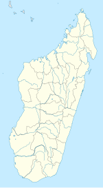
Ankaratra is located in Madagascar
Ankaratra
Location of Ankaratra range
Ankaratra and Antsirabe

Ankaratra is a cinder cone volcano range located about 50 km (30 mi) southwest of Antananarivo, the capital city of Madagascar. It lies between the towns of Arivonimamo to the north, Ambatolampy to the east, Faratsiho to the west and Betafo to the south. It is located in the Central Highlands. The highest peak in Ankaratra is Mount Tsiafajavona ("never out of the fog"), at 2,644 metres (8,668 ft.) above sea level. Some trace of activity remains in the southernmost part of the range, creating hot springs in the area around Antsirabe. The last eruption of Ankaratra took place in the very recent Quaternary.[1]
See also

[edit]

References

[edit]
  1. ^ "Ankaratra Field".

19°25′S 47°12′E / 19.417°S 47.200°E / -19.417; 47.200

pFad - Phonifier reborn

Pfad - The Proxy pFad of © 2024 Garber Painting. All rights reserved.

Note: This service is not intended for secure transactions such as banking, social media, email, or purchasing. Use at your own risk. We assume no liability whatsoever for broken pages.


Alternative Proxies:

Alternative Proxy

pFad Proxy

pFad v3 Proxy

pFad v4 Proxy