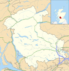
Ardeonaig
Appearance
Ardeonaig
| |
|---|---|
 Ardeonaig Hotel | |
Location within the Stirling council area | |
| OS grid reference | NN669357 |
| Civil parish | |
| Council area | |
| Lieutenancy area | |
| Country | Scotland |
| Sovereign state | United Kingdom |
| Post town | Killin |
| Postcode district | FK21 |
| Dialling code | 01567 |
| Police | Scotland |
| Fire | Scottish |
| Ambulance | Scottish |
| UK Parliament | |
| Scottish Parliament | |
Ardeonaig (Gaelic: Aird Eòdhanaig) is a hamlet on the southern shore of Loch Tay in the Stirling Council area of Scotland. It is approximately 7 miles east of Killin and lies at the mouth of the Ardeonaig Burn where it enters Loch Tay.[1]
When boats operated by the Loch Tay Steamboat Company ran on the loch they stopped at Ardeonaig, where coal was delivered and passengers could disembark. Now, fishing trips on Loch Tay stop at the Ardeonaig Hotel jetty to disembark for lunch before continuing down the Loch. There must have been a ferry service because the minister came by boat to conduct church services. At Ardeonaig there was an outdoor centre, run by the Abernethy Trust.
References
[edit]- ^ "Loch Tay and Glen Dochart", Ordnance Survey Landranger Map (B2 ed.), 2008, ISBN 0-319-22979-3
External links
[edit]Wikimedia Commons has media related to Ardeonaig.
- Vision of Britain - Ardeonaig
- Canmore - Ardeonaig, Old Manse site record
- Canmore - Mains Castle site record
