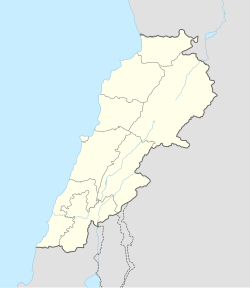
Arida, Lebanon
Appearance
Arida
العريضة | |
|---|---|
| Coordinates: 34°38′00″N 35°58′40″E / 34.63333°N 35.97778°E | |
| Country | |
| Governorate | Akkar |
| District | Akkar |
| Time zone | UTC+2 (EET) |
| • Summer (DST) | +3 |
Arida (Arabic: العريضة) is a village in northern Lebanon, on the Syrian border, which is formed by the mouth of the Nahr al-Kabir al-Janoubi. It is located in the Akkar District of the Akkar Governorate.[1] Its inhabitants are Sunni Muslims.[2] The Arida Border Crossing is the coastal border crossing between Lebanon and Syria.
References
[edit]- ^ "Aarida". Localiban. 2006-06-24. Archived from the original on 2017-12-01. Retrieved 2017-11-26.
- ^ "Municipal and ikhtariyah elections in northern Lebanon" (PDF). The Monthly (92): 22. March 2019.

