Arutua Airport
Appearance
Arutua Airport | |||||||||||
|---|---|---|---|---|---|---|---|---|---|---|---|
| Summary | |||||||||||
| Serves | Arutua, French Polynesia | ||||||||||
| Coordinates | 15°14′47″S 146°37′13″W / 15.24639°S 146.62028°W | ||||||||||
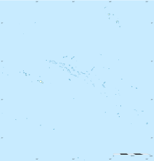
| Map | |||||||||||
| Runways | |||||||||||
| |||||||||||
Arutua Airport is an airport on Arutua atoll in French Polynesia (IATA: AXR, ICAO: NTGU). The airport is 13 km north of the village of Rautini.
Airlines and destinations
[edit]| Airlines | Destinations |
|---|---|
| Air Tahiti | Ahe, Papeete[2] |
Statistics
[edit]Graphs are unavailable due to technical issues. There is more info on Phabricator and on MediaWiki.org. |
Annual passenger traffic at AXR airport.
See Wikidata query.
See also
[edit]References
[edit]- ^ "NTGU - Arutu". AC-U-KWIK. Retrieved 13 November 2021.
- ^ "Download forecast schedule - Official website - Air Tahiti".
External links
[edit]- NTGU – ARUTA. AIP from French Service d'information aéronautique, effective 5 September 2024.
15°14′47″S 146°37′13″W / 15.24639°S 146.62028°W
