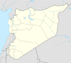
Baruza
Appearance
Baruza
الباروزة | |
|---|---|
Village | |
| Coordinates: 36°28′54″N 37°20′56″E / 36.4817°N 37.3489°E | |
| Country | Syria |
| Governorate | Aleppo |
| District | Azaz |
| Subdistrict | Akhtarin |
| Control | |
| Elevation | 494 m (1,621 ft) |
| Population (2004)[1] | 992 |
| Time zone | UTC+2 (EET) |
| • Summer (DST) | UTC+3 (EEST) |
| Geocode | C1582 |
Baruza (Arabic: الباروزة, romanized: al-Bārūzah) is a village in northern Aleppo Governorate, northwestern Syria. 3.5 kilometres (2.2 mi) south of Akhtarin and some 30 km (19 mi) northeast of the city of Aleppo, it is situated on the southeastern edge of the Queiq Plain, where the Aqil mountains begin.
The village administratively belongs to Nahiya Akhtarin in Azaz District. Nearby localities include Ghaytun 4 km (2.5 mi) to the west, and Tall Tanah 2 km (1.2 mi) to the south. In the 2004 census, Baruza had a population of 992.[1]
References
[edit]- ^ a b "2004 Census Data for Nahiya Akhtarin" (in Arabic). Syrian Central Bureau of Statistics. Also available in English: UN OCHA. "2004 Census Data". Humanitarian Data Exchange.


