Beaumont Chase
Appearance
| Beaumont Chase | |
|---|---|
 View from Beaumont Chase towards Stockerston and the Eye Brook valley | |
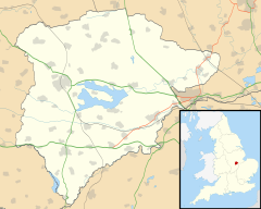
Location within Rutland | |
| Area | 0.72 sq mi (1.9 km2) [1] |
| Population | 0 2001 Census[2] |
| • Density | 0/sq mi (0/km2) |
| OS grid reference | SP842986 |
| • London | 79 miles (127 km) SSE |
| Unitary authority | |
| Shire county | |
| Ceremonial county | |
| Region | |
| Country | England |
| Sovereign state | United Kingdom |
| Post town | OAKHAM |
| Postcode district | LE15 |
| Dialling code | 01572 |
| Police | Leicestershire |
| Fire | Leicestershire |
| Ambulance | East Midlands |
| UK Parliament | |
Beaumont Chase is a civil parish in the county of Rutland in the East Midlands of England. It is to the west of Uppingham, north of Stoke Dry, and on a hillside overlooking Leicestershire. Formerly an extra-parochial area, it was created a separate parish in 1858.
The civil parish's name means 'Beautiful hill'. 'Chase' is a later addition which means a place for breeding and hunting wild animals.[3]
There is only a single occupied building, a farmhouse. According to the 2001 census, Beaumont Chase had a population of zero.
References
[edit]- ^ "A vision of Britain through time". University of Portsmouth. Retrieved 28 January 2009.
- ^ "Rutland Civil Parish Populations" (PDF). Rutland County Council. 2001. Archived from the original (PDF) on 29 July 2014. Retrieved 29 July 2014.
- ^ "Key to English Place-names".
Wikimedia Commons has media related to Beaumont Chase.
