Bede, Manitoba
Appearance
This article includes a list of general references, but it lacks sufficient corresponding inline citations. (May 2020) |
Bede | |
|---|---|
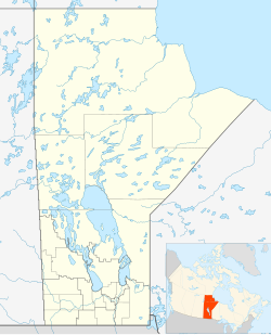
Location of Bede in Manitoba | |
| Coordinates: 49°23′56″N 100°58′7″W / 49.39889°N 100.96861°W | |
| Country | |
| Province | |
| Region | Westman Region |
| Census Division | No. 5 |
| Government | |
| • MP | Larry Maguire |
| • MLA | Doyle Piwniuk |
| Time zone | UTC−6 (CST) |
| • Summer (DST) | UTC−5 (CDT) |
| Area code | 204 |
| NTS Map | 062F07 |
| GNBC Code | GACBL |
Bede is a community in the Municipality of Two Borders, Manitoba, Canada. The community is located at the intersection of Highway 345 & Highway 83 between the communities of Broomhill and Bernice, approximately 115 km south-west of Brandon, Manitoba only 16 km north of the Town of Melita. Very little remains of Bede, only a historic school house and the community cemetery remain.
The first Post Office, located on 30-5-26W, was opened under the name of Shilson in 1897. It became Ruth in 1908 and was located on 18-5-26W. The P.O. became Bede in 1925. It became a Canadian Pacific railway point in 1906.
Infrastructure
[edit]Bede is served by Manitoba highways 345 and 83.
See also
[edit]References
[edit]- ^ "Population and dwelling counts, for Canada and census subdivisions (municipalities), 2006 and 2001 censuses - 100% data". Statistics Canada, 2006 Census of Population. November 5, 2008. Retrieved January 30, 2009.
- Geographic Names of Manitoba (pg. 22) - the Millennium Bureau of Canada

