Belaga Airport
Appearance
Belaga Airport Lapangan Terbang Belaga | |||||||||||
|---|---|---|---|---|---|---|---|---|---|---|---|
| Summary | |||||||||||
| Airport type | Public | ||||||||||
| Operator | Malaysia Airports Berhad | ||||||||||
| Serves | Belaga, Sarawak, Malaysia | ||||||||||
| Time zone | MST (UTC+08:00) | ||||||||||
| Elevation AMSL | 200 ft / 61 m | ||||||||||
| Coordinates | 02°38′10″N 113°45′38″E / 2.63611°N 113.76056°E | ||||||||||
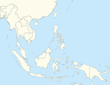
| Map | |||||||||||
Location in Sarawak, East Malaysia | |||||||||||
 | |||||||||||
| Runways | |||||||||||
| |||||||||||
Belaga Airport (IATA: BLG[2], ICAO: WBGC) is an airport in Belaga, Sarawak, Malaysia.
Airlines and destinations
[edit]Following the takeover routes by MASwings from FlyAsianXpress, the Bintulu-Belaga route has been ceased.
See also
[edit]References
[edit]- ^ AIP Malaysia: Index to Aerodromes at Department of Civil Aviation Malaysia
- ^ Airport information for BLG at Great Circle Mapper.
External links
[edit]- Short Take-Off and Landing Airports (STOL) at Malaysia Airports Holdings Berhad
- Accident history for BLG at Aviation Safety Network


