Berthelming
Appearance
Berthelming | |
|---|---|
The cemetery chapel in Berthelming | |
| Coordinates: 48°49′01″N 7°00′23″E / 48.8169°N 7.0064°E | |
| Country | France |
| Region | Grand Est |
| Department | Moselle |
| Arrondissement | Sarrebourg-Château-Salins |
| Canton | Sarrebourg |
| Government | |
| • Mayor (2020–2026) | Claude Erhard[1] |
Area 1 | 10.67 km2 (4.12 sq mi) |
| Population (2022)[2] | 508 |
| • Density | 48/km2 (120/sq mi) |
| Time zone | UTC+01:00 (CET) |
| • Summer (DST) | UTC+02:00 (CEST) |
| INSEE/Postal code | 57066 /57930 |
| Elevation | 231–282 m (758–925 ft) (avg. 250 m or 820 ft) |
| 1 French Land Register data, which excludes lakes, ponds, glaciers > 1 km2 (0.386 sq mi or 247 acres) and river estuaries. | |
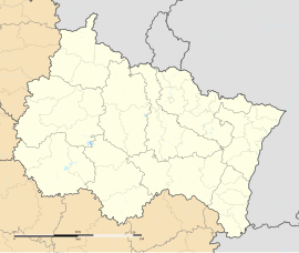
Berthelming (French pronunciation: [bɛʁtəlmɛ̃]; German: Berthelmingen) is a commune in the Moselle department in Grand Est in northeastern France. It has a railway station on the line from Metz to Strasbourg.
History
[edit]The village was part of the seigneury of Fénétrange-Schwanhals. The commune was destroyed during the Thirty Years' War.
Population
[edit]| Year | Pop. | ±% p.a. |
|---|---|---|
| 1968 | 587 | — |
| 1975 | 556 | −0.77% |
| 1982 | 568 | +0.31% |
| 1990 | 501 | −1.56% |
| 1999 | 520 | +0.41% |
| 2009 | 514 | −0.12% |
| 2014 | 503 | −0.43% |
| 2020 | 512 | +0.30% |
| Source: INSEE[3] | ||
Cultural heritage and architecture
[edit]The village houses the remains of a Gallo-Roman villa.
A fortified house from the medieval period is still visible nowadays.
See also
[edit]References
[edit]- ^ "Répertoire national des élus: les maires" (in French). data.gouv.fr, Plateforme ouverte des données publiques françaises. 13 September 2022.
- ^ "Populations de référence 2022" (in French). The National Institute of Statistics and Economic Studies. 19 December 2024.
- ^ Population en historique depuis 1968, INSEE
External links
[edit] Media related to Berthelming at Wikimedia Commons


