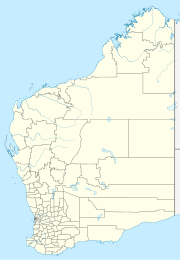
Broomehill West, Western Australia
| Broomehill West Western Australia | |||||||||||||||
|---|---|---|---|---|---|---|---|---|---|---|---|---|---|---|---|
 | |||||||||||||||
| Coordinates | 33°52′33″S 117°28′43″E / 33.87571°S 117.47861°E | ||||||||||||||
| Population | 173 (SAL 2021)[1] | ||||||||||||||
| Postcode(s) | 6318 | ||||||||||||||
| Area | 627.1 km2 (242.1 sq mi) | ||||||||||||||
| Location | |||||||||||||||
| LGA(s) | Shire of Broomehill–Tambellup | ||||||||||||||
| State electorate(s) | Roe | ||||||||||||||
| Federal division(s) | O'Connor | ||||||||||||||
| |||||||||||||||
Broomehill West is a rural locality of the Shire of Broomehill–Tambellup of the Great Southern region of Western Australia, adjacent to the town of Broomehill. The Great Southern Highway and the Great Southern Railway, for the most part, form the eastern border of the locality. A small part of the gazetted townsite of Peringillup and a major part of the Peringillup Nature Reserve are located within Broomehill West.[2][3]
The west of the Shire of Broomehill–Tambellup, including Broomehill West, is located on the traditional land of the Kaniyang people of the Noongar nation,[4] while the east of the shire is located on the traditional lands of the Koreng people, also of the Noongar nation.[5][6]
The townsite of Peringillup, located in the south-east of Broomehill West and in neighbouring Broomehill East, was established in 1907 as a siding on the Great Southern Railway.[7] The town of Broomehill was established just prior to the completion of this railway in 1889, and gazetted in 1890.[8]
The heritage listed Condeena Estate is located within Broomehill West, dating back to 1904.[9]
Nature reserve
[edit]The Peringillup Nature Reserve was gazetted on 12 October 1979, has a size of 2.18 square kilometres (0.84 sq mi), and is located within the Avon Wheatbelt bioregion.[10]
References
[edit]- ^ Australian Bureau of Statistics (28 June 2022). "Broomehill West (suburb and locality)". Australian Census 2021 QuickStats. Retrieved 28 June 2022.
- ^ "SLIP Map". maps.slip.wa.gov.au. Landgate. Retrieved 29 October 2024.
- ^ "NationalMap". nationalmap.gov.au. Geoscience Australia. Retrieved 29 October 2024.
- ^ "Kaneang (WA)". www.samuseum.sa.gov.au. South Australian Museum. Retrieved 29 October 2024.
- ^ "Koreng (WA)". www.samuseum.sa.gov.au. South Australian Museum. Retrieved 29 October 2024.
- ^ "Map of Indigenous Australia". aiatsis.gov.au. Australian Institute of Aboriginal and Torres Strait Islander Studies. 14 May 2024. Retrieved 29 October 2024.
- ^ "History of country town names – P". Western Australian Land Information Authority. Archived from the original on 14 March 2022. Retrieved 29 October 2024.
- ^ "History of country town names – B". Western Australian Land Information Authority. Archived from the original on 14 March 2022. Retrieved 29 October 2024.
- ^ "Condeena Estate, Broomehill". inherit.stateheritage.wa.gov.au. Heritage Council of Western Australia. Retrieved 29 October 2024.
- ^ "Terrestrial CAPAD 2022 WA summary". www.dcceew.gov.au/. Department of Climate Change, Energy, the Environment and Water. Retrieved 29 October 2024.
