Cedar, Wisconsin
Appearance
Cedar, Wisconsin | |
|---|---|
 Sign | |
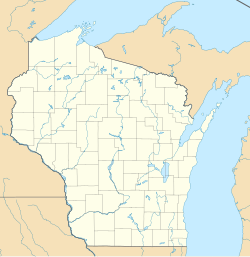
| Coordinates: 46°30′26″N 90°29′54″W / 46.50722°N 90.49833°W | |
| Country | |
| State | |
| County | Iron |
| Town | Gurney |
| Elevation | 330 m (1,083 ft) |
| Time zone | UTC-6 (Central (CST)) |
| • Summer (DST) | UTC-5 (CDT) |
| Area code(s) | 715 & 534 |
| GNIS feature ID | 1578967[1] |
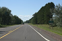
Cedar is an unincorporated community located in the town of Gurney, Iron County, Wisconsin, United States. Cedar is located on U.S. Route 2 4 miles (6.4 km) west-northwest of Saxon.
History
[edit]A post office called Cedar was established in 1891, and remained in operation until it was discontinued in 1955.[2] The community was named from groves of cedar near the town site.[3]
References
[edit]- ^ U.S. Geological Survey Geographic Names Information System: Cedar, Wisconsin
- ^ "Iron County". Jim Forte Postal History. Retrieved February 28, 2015.
- ^ Chicago and North Western Railway Company (1908). A History of the Origin of the Place Names Connected with the Chicago & North Western and Chicago, St. Paul, Minneapolis & Omaha Railways. p. 53.
External links
[edit]![]() Media related to Cedar, Wisconsin at Wikimedia Commons
Media related to Cedar, Wisconsin at Wikimedia Commons


