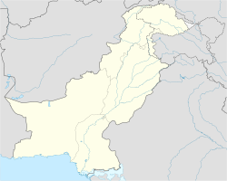
Chathian Wala
Appearance
Chathian Wala | |
|---|---|
Town | |
| Coordinates: 30°56′56″N 73°44′36″E / 30.94889°N 73.74333°E | |
| Country | |
| Province | Punjab |
| District | Kasur |
| Time zone | UTC+5 (PST) |
Chathian Wala is a town and Union Council of Kasur District in the Punjab province of Pakistan.[1] It is part of Kasur Tehsil and is located at 31°18'0N 74°31'0E with an altitude of 207 metres (682 feet).[2]
The town was the main centre for the Gulabdasi sect.[3]
References
[edit]- ^ Tehsils & Unions in the District of Kasur - Government of Pakistan Archived August 7, 2011, at the Wayback Machine
- ^ Location of Chathanwala - Falling Rain Genomics
- ^ Malhotra, Anshu. "Living and Defining Caste: The Life and Writing of Giani Ditt Singh / Sant Ditta Ram" (PDF). Journal of Punjab Studies. 20 (1): 159–192.

