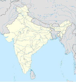
Dhatala
Appearance
Dhatala
Dhatla | |
|---|---|
Village | |
| Coordinates: 23°31′59.9″N 86°55′59.9″E / 23.533306°N 86.933306°E | |
| Country | |
| State | West Bengal |
| District | Bankura |
| Founded by | unknown |
| Named for | unknown |
| Government | |
| • Type | TMC |
| Population (2011) | |
• Total | 2,302(approximalty) |
Dhatala is a small village between Shyampur and Rampur. It is 1 km away from the village Shyampur. It is under Saltora police station.
Schools
[edit]There is a primary school in the village named
- Dhatla Primary School
Demographics
[edit]According to 2011 Census of India
- Total population =2,302
- Males= (51%)
- Females= (49%)
- Population below= 6 years was 300 .[1]
Nearest villages
[edit]See also
[edit]References
[edit]- ^ "2011 Census – Primary Census Abstract Data Tables". West Bengal – District-wise. Registrar General and Census Commissioner, India.


