

Dodi Island
 Dodi Island Rocky Shores | |
 | |
| Geography | |
|---|---|
| Location | South Ghana |
| Coordinates | 6°33′35″N 0°06′44″E / 6.55969°N 0.11231°E |
| Adjacent to | Lake Volta |
| Area | 0.625 km2 (0.241 sq mi) |
| Administration | |
| Region | Eastern Region |
| Demographics | |
| Population | 600 (2012) |
Dodi Island is an island in Ghana, located 5 kilometres (3 nmi; 3 mi) off the shore of Lake Volta.[1] It is a tourist destination and was a landing place for the Ghanaian former cruise ship Dodi Princess, which was used for cruises on Lake Volta.[2]
Gallery
[edit]- Tourism in Dodi Island
-
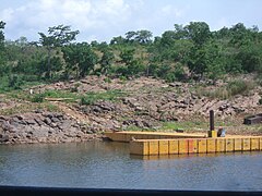
 Rocky shores of Dodi Island.
 -
-
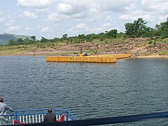
 Cruiseliner pier of Dodi Island.


See also
[edit]Wikimedia Commons has media related to Dodi Island.
References
[edit]- ^ "Dodi Island". Retrieved 11 July 2013.
- ^ "Minister seeks private sector investment for Dodi Island". ghanaweb.com. Retrieved 11 July 2013.