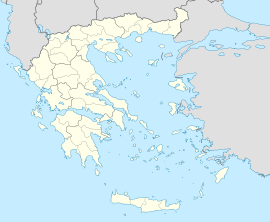
Domokos
Domokos
Δομοκός | |
|---|---|
Domokos | |
| Coordinates: 39°08′N 22°18′E / 39.133°N 22.300°E | |
| Country | Greece |
| Administrative region | Central Greece |
| Regional unit | Phthiotis |
| Area | |
• Municipality | 707.95 km2 (273.34 sq mi) |
| • Municipal unit | 346.13 km2 (133.64 sq mi) |
| Population (2021)[1] | |
• Municipality | 9,159 |
| • Density | 13/km2 (34/sq mi) |
| • Municipal unit | 4,273 |
| • Municipal unit density | 12/km2 (32/sq mi) |
| • Community | 1,814 |
| Time zone | UTC+2 (EET) |
| • Summer (DST) | UTC+3 (EEST) |
| Vehicle registration | ΜΙ |
Domokos (Greek: Δομοκός), the ancient Thaumacus or Thaumace (Θαυμακός, Θαυμάκη),[2] is a town and a municipality in Phthiotis, Greece. The town Domokos is the seat of the municipality of Domokos[3] and of the former Domokos Province. The town is built on a mountain slope overlooking the plain of Thessaly, 38 km from the city of Lamia.
History
[edit]Ancient
[edit]Modern
[edit]The area of Domokos became part of Greece in 1881 when the Ottoman Empire ceded Thessaly and a few adjacent areas to Greece. Until 1899, it was part of the Larissa Prefecture.
Ottoman Era
[edit]In 1521 (Hijri 927) the town, known in Ottoman Turkish as Dömeke, had six Muslim and 311 Christian households in nine neighborhoods.[4] The castle of the town is mentioned as Dimoko in the Seyahatnâme of Evliya Çelebi, which he visited in 1668. He mentions that there were around a hundred tiled houses, with Muslims constituting only one neighborhood and having a mosque, and that the inner castle was inhabited by the Greeks since the beginning of the Ottoman conquest. He points out that the Muslims are mixed with Christians and are unaware of their denomination, and that they are relieved of paying the haraç tax. He also mentioned the antisemitism of the town, saying that "they do not allow Jews in this city, and the Jews do not come out of fear".[5][6]
Battle of Domokos
[edit]In 1897, during the Greco-Turkish War, about 2,000 Italian volunteers under the command of Giuseppe Garibaldi's son, Ricciotti Garibaldi, helped the Greeks in the Battle of Domokos. Among them there was also a member of the Italian Parliament, Antonio Fratti, who died in the fighting. The Turkish Army was victorious over the Greek Army.
Transport
[edit]The town is served by Domokos railway station on the Piraeus–Platy Mainline, which is located 5 km from the city and serves the surrounding area.
You can also visit the town via frequent buses that pass by the town.
Municipality
[edit]The municipality Domokos was formed during the 2011 local government reforms by the merger of the following 3 former municipalities, that became municipal units:[3]
- Domokos
- Thessaliotida
- Xyniada
The municipality has an area of 707.953 km2, the municipal unit 346.129 km2.[7]
Province
[edit]The province of Domokos (Greek: Επαρχία Δομοκού) was one of the provinces of Phthiotis. It had the same territory as the present municipality.[8] It was abolished in 2006.
Notable people
[edit]- Christos Panagioulas (b. 1882), politician
References
[edit]- ^ "Αποτελέσματα Απογραφής Πληθυσμού - Κατοικιών 2021, Μόνιμος Πληθυσμός κατά οικισμό" [Results of the 2021 Population - Housing Census, Permanent population by settlement] (in Greek). Hellenic Statistical Authority. 29 March 2024.
- ^ Lewis and Short
- ^ a b "ΦΕΚ A 87/2010, Kallikratis reform law text" (in Greek). Government Gazette.
- ^ GÖKBİLGİN, M. TAYYİB (1956). "KANUNÎ SULTAN SÜLEYMAN DEVRİ BAŞLARINDA RUMELİ EYALETİ, LİVALARI, ŞEHİR VE KASABALARI". Belleten. 20 (78): 278. eISSN 2791-6472. ISSN 0041-4255.
- ^ Evliya, Çelebi (2011). Kahraman, Seyit Ali (ed.). Günümüz Türkçesiyle Evliyâ Çelebi Seyahatnâmesi 8. Kitap (in Turkish). Yücel Dağlı (6. ed.). İstanbul: Yapı Kredi Yayınları. p. 215. ISBN 978-975-08-0562-2. OCLC 1017937898.
Rumeli Eyaleti'nde İnebahtı Sancağı voyvodalığında Çatalca kazası nahiyesinin niyabetidir. Aşağıdan kalesine 1 saatte çıkıp seyrettim. Kalesi, göklere çıkmış bir sivri kaya üzerinde yuvarlak ve şeddadi taş yapı küçük bir kaledir. Fetihten sonra bazı yerleri yıkılmıştır. Bütün kafiri ve Müslümanları ancak 100 kadar kiremit örtülü evlerdir. Rumları fetihten beri iç kalenin tepesinde sakinler. Oradan aşağıda Müslümanlar olup 1 mahalle ve 1 cami var, ama Müslümanlarının dinleri ve mezhepleri nedir, onlar da bilmez. Kefereler ile karışmış Müslüman şekilli, haraç vermeden kurtulmuş bir kavimdir. Hepsi 2 hanları ve 50 adet dükkanları var, ama hamamı ve başka imaretleri yoktur. Abıhayat kaynak suları çoktur, bağ bahçeleri uzaktır. Bu kale anayola aykırı olmakla bu kavim asla misafir almazlar, Yahudi kavmini bu şehre koymazlar ve Yahudiler de korkup gelmezler.
- ^ Yerasimos, Marianna (2020-05-27), Anadol, Çağatay; Eldem, Edhem; Pekin, Ersu; Tibet, Aksel (eds.), "Evliya Çelebi Seyahatnâmesi'nde Yunanistan: Rota ve Güzergâhlar", Bir allame-i cihan : Stefanos Yerasimos (1942-2005), IFEA/Kitap yayınevi, İstanbul: Institut français d'études anatoliennes, pp. 735–835, ISBN 978-2-36245-044-0, retrieved 2023-02-06
- ^ "Population & housing census 2001 (incl. area and average elevation)" (PDF) (in Greek). National Statistical Service of Greece. Archived from the original (PDF) on 2015-09-21.
- ^ "Detailed census results 1991" (PDF). Archived from the original (PDF) on 2016-03-03. (39 MB) (in Greek and French)
External links
[edit]- Municipality of Domokos (in Greek and English)


