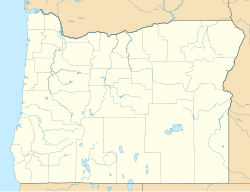
Dorena, Oregon
Dorena, Oregon | |
|---|---|
 Dorena Mercantile | |
| Coordinates: 43°43′11″N 122°51′43″W / 43.71972°N 122.86194°W | |
| Country | United States |
| State | Oregon |
| County | Lane |
| Elevation | 922 ft (281 m) |
| Time zone | UTC-8 (Pacific (PST)) |
| • Summer (DST) | UTC-7 (PDT) |
| ZIP code | 97434 |
| Area code(s) | 458 and 541 |
| GNIS feature ID | 1141192 |
Dorena is an unincorporated community in Lane County, Oregon, United States.[1] It is located southeast of Cottage Grove on the Row River, a tributary of the Coast Fork Willamette River.
History
[edit]The first settlers arrived in the Dorena area in the 1850s and depended on agriculture to survive, but later logging and gold mining became the mainstays of the local economy.[2] Dorena was named by combining the first names of Dora Burnette and Lorena Martin.[3] Dorena school was built in 1896,[4] and Dorena post office was established in 1899.[5] In 1946, the town was abandoned when the Corps of Engineers began construction of Dorena Dam on the Row River for flood control.[3][4] The Corps relocated approximately one hundred homes from the town's former site at 43°46′32″N 122°55′38″W / 43.77556°N 122.92722°W.[6] The dam was completed in 1949 and created Dorena Reservoir, which flooded the townsite.[3] The community was moved five miles upriver.[3]
Climate
[edit]This region experiences warm (but not hot) and dry summers, with no average monthly temperatures above 71.6 °F (22.0 °C). According to the Köppen Climate Classification system, Dorena has a warm-summer Mediterranean climate, abbreviated "Csb" on climate maps.[7]
Transportation
[edit]The Row River Trail, a rails to trails conversion of a former Oregon, Pacific and Eastern Railway line, passes through Dorena.[8]
References
[edit]- ^ a b "Dorena, Oregon". Geographic Names Information System. United States Geological Survey, United States Department of the Interior. Retrieved March 1, 2013.
- ^ "The Challenges of a New Place: 'June 21. Rained hard.'". Center for Columbia River History. Archived from the original on October 21, 2007. Retrieved November 22, 2007.
- ^ a b c d McArthur, Lewis A.; McArthur, Lewis L. (2003) [1928]. Oregon Geographic Names (7th ed.). Portland, Oregon: Oregon Historical Society Press. p. 298. ISBN 978-0875952772.
- ^ a b "Our Schools: Dorena". South Lane School District. Retrieved June 9, 2009.
- ^ "Lane County". Jim Forte Postal History. Archived from the original on April 15, 2015. Retrieved April 23, 2015.
- ^ "Dorena Dam". Center for Columbia River History. Archived from the original on August 20, 2008. Retrieved November 22, 2007.
- ^ Climate Summary for Dorena, Oregon
- ^ "Welcome to the Row River Trail". City of Cottage Grove. Archived from the original on October 19, 2007. Retrieved November 22, 2007.
External links
[edit]- Historic images of the Dorena area from Salem Public Library
- 1911 image of students inside Dorena School from University of Oregon Library


