Hørning railway station
Appearance
Hørning | |||||||||||
|---|---|---|---|---|---|---|---|---|---|---|---|
| railway station | |||||||||||
Hørning station in 2010 | |||||||||||
| General information | |||||||||||
| Location | Stationspladsen 2 8362 Hørning[1][2] Skanderborg Municipality Denmark | ||||||||||
| Coordinates | 56°4′56″N 10°2′16″E / 56.08222°N 10.03778°E | ||||||||||
| Elevation | 52.3 metres (172 ft)[3] | ||||||||||
| Owned by | Banedanmark | ||||||||||
| Operated by | GoCollective | ||||||||||
| Line(s) | Fredericia–Aarhus railway line | ||||||||||
| Platforms | 2 | ||||||||||
| Tracks | 2 | ||||||||||
| Services | |||||||||||
| |||||||||||
| |||||||||||
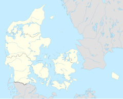
Hørning station is a railway station serving the suburb of Hørning south of the city of Aarhus in East Jutland, Denmark.[1][2]
The station is located on the Fredericia–Aarhus railway line from Fredericia to Aarhus. It offers regional train services to Aarhus, Esbjerg, Herning and Skjern. The train services are operated by the railway company GoCollective.
See also
[edit]References
[edit]Citations
[edit]- ^ a b "Hørning Station" (in Danish). GoCollective. Retrieved 20 April 2024.
- ^ a b "Hørning Station" (in Danish). DSB. Retrieved 10 May 2021.
- ^ "Hørning Trinbræt (Hx)". danskejernbaner.dk (in Danish). Retrieved 19 October 2024.
Bibliography
[edit]- Jensen, Niels (1978). Østjyske jernbaner (in Danish). Copenhagen: J.Fr. Clausens Forlag. ISBN 87-11-03852-7.
External links
[edit]Wikimedia Commons has media related to Hørning Station.
- (in Danish) Banedanmark – government agency responsible for maintenance and traffic control of most of the Danish railway network
- (in Danish) GoCollective – private public transport company operating bus and train services in Denmark
- (in Danish) Danske Jernbaner – website with information on railway history in Denmark

