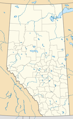
Hemaruka, Alberta
Appearance
Hemaruka | |
|---|---|
Location of Hemaruka in Special Area No. 4 | |
| Coordinates: 51°47′00″N 111°06′06″W / 51.78342°N 111.10172°W | |
| Country | Canada |
| Province | Alberta |
| Region | Central Alberta |
| Census division | No. 4 |
| Special Area | Special Area No. 4 |
| Government | |
| • Type | Unincorporated |
| • Governing body | Special Areas Board |
| Time zone | UTC-7 (Mountain Time Zone) |
| • Summer (DST) | UTC-6 (Mountain Time Zone) |
| Highways | |
Hemaruka is a hamlet in Alberta, Canada that is under the jurisdiction of the Special Areas Board.[1]
Hemaruka is a name coined from the first two letters of Helen, Mary, Ruth and Kate, the daughters of a railroad official.[2]
See also
[edit]References
[edit]- ^ "Specialized and Rural Municipalities and Their Communities" (PDF). Alberta Municipal Affairs. June 3, 2024. Retrieved June 14, 2024.
- ^ Place-names of Alberta. Ottawa: Geographic Board of Canada. 1928. p. 64.

