Kamilche Hill
Appearance
| Kamilche Hill | |
|---|---|
| Highest point | |
| Elevation | 369.8 m (1,213 ft)(NAVD 88)[1] |
| Prominence | 190 m (620 ft)[2] |
| Coordinates | 47°08′19.27787″N 123°08′26.15924″W / 47.1386882972°N 123.1405997889°W (NAD 83)[1] |
| Naming | |
| Language of name | Lushootseed |
| Pronunciation | Ka-mil-chee |
| Geography | |
| Topo map | Shelton Valley 1:24,000 |
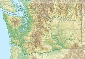
Kamilche Hill is a 1,213-foot (370 m) peak in Mason County, Washington about 2 miles (3 km) northwest of the Puget Sound community of Kamilche.[1][2] The summit is within a large private forest owned by Simpson Timber Company.[1] The peak has radio equipment including the KRXY transmitter.[3]
References
[edit]- ^ a b c d National Geodetic Survey benchmark database: benchmark "Kamilche 2" (SY1810) datasheet, retrieved 4 May 2017
- ^ a b "Kamilche Hill". Peakbagger.com.
- ^ FCC radio transmitter database-KRXY, retrieved 4 May 2017
