Karpinsk
Karpinsk
Карпинск | |
|---|---|
View of Karpinsk | |
| Coordinates: 59°46′N 59°59′E / 59.767°N 59.983°E | |
| Country | Russia |
| Federal subject | Sverdlovsk Oblast[1] |
| Founded | 1941 |
| Town status since | 1941 |
| Elevation | 210 m (690 ft) |
| Population | |
• Total | 29,113 |
| • Subordinated to | Town of Karpinsk[1] |
| • Capital of | Town of Karpinsk[3] |
| • Urban okrug | Karpinsk Urban Okrug[4] |
| • Capital of | Karpinsk Urban Okrug[5] |
| Time zone | UTC+5 (MSK+2 |
| Postal code(s)[7] | 624930–624933, 624936 |
| OKTMO ID | 65742000001 |
| Website | karpinsk |
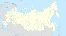
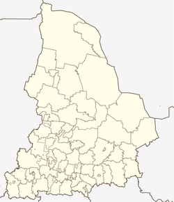
Karpinsk (Russian: Карпи́нск) is a town in Sverdlovsk Oblast, Russia, located on the Turya River (Ob's basin), 436 kilometers (271 mi) north of Yekaterinburg, the administrative center of the oblast. Population: 29,113 (2010 Census);[2] 31,216 (2002 Census);[8] 36,968 (1989 Soviet census).[9] The town is named for mineralogist and geologist Alexander Karpinsky.
History
[edit]The settlement of Bogoslovsk (Богосло́вск) was founded in either 1759 or in 1769. It remained one of the largest copper production centers in the Urals until 1917. Coal deposits started to be mined in 1911. In 1941, the settlement of Bogoslovsky (Богосло́вский) merged with the nearby settlement of Ugolny (У́гольный) to form the town of Karpinsk.[citation needed]
From 1945 to 1949, there existed close to Karpinsk a labor camp for Russo-Germans and German civilians, who for the most part were forcibly displaced from East Prussia and Pomerania to be used as forced labor. They were women and men between fifteen and sixty-five years of age. Those capable of work were forced to engage in strip-mining of lignite, used in housing construction and road construction, labored in a stone quarry, and at times served as skilled laborers in various workshops. Seasonally, work brigades were sent into the taiga as forest laborers. Moreover, prisoner-of-war camp #504 for German POWs from World War II was located in Karpinsk.
Administrative and municipal status
[edit]Within the framework of the administrative divisions, it is, together with the town of Volchansk and ten rural localities, incorporated as the Town of Karpinsk[1]—an administrative unit with the status equal to that of the districts.[10] As a municipal division, Karpinsk and eight rural localities are incorporated as Karpinsk Urban Okrug.[4][1] The town of Volchansk, together with the remaining two rural localities, is incorporated separately as Volchansky Urban Okrug.[4][1]
Sports
[edit]Bandy player Mikhail Sveshnikov comes from the town.[11] After the 2011-2012 season, he was acknowledged as the second best player of the national championship.[citation needed] He has become a citizen of honour in Karpinsk.[1]
The local bandy club is Sputnik,[12] where Oleg Sveshnikov, the father of Mikhail, is a coach.
See also
[edit]- Volchansk tram system (defunct interurban line to Karpinsk)
References
[edit]Notes
[edit]- ^ a b c d e f Order #120-P
- ^ a b Russian Federal State Statistics Service (2011). Всероссийская перепись населения 2010 года. Том 1 [2010 All-Russian Population Census, vol. 1]. Всероссийская перепись населения 2010 года [2010 All-Russia Population Census] (in Russian). Federal State Statistics Service.
- ^ Государственный комитет Российской Федерации по статистике. Комитет Российской Федерации по стандартизации, метрологии и сертификации. №ОК 019-95 1 января 1997 г. «Общероссийский классификатор объектов административно-территориального деления. Код 65 445», в ред. изменения №278/2015 от 1 января 2016 г.. (State Statistics Committee of the Russian Federation. Committee of the Russian Federation on Standardization, Metrology, and Certification. #OK 019-95 January 1, 1997 Russian Classification of Objects of Administrative Division (OKATO). Code 65 445, as amended by the Amendment #278/2015 of January 1, 2016. ).
- ^ a b c Law #85-OZ
- ^ Федеральная служба государственной статистики. Федеральное агентство по технологическому регулированию и метрологии. №ОК 033-2013 1 января 2014 г. «Общероссийский классификатор территорий муниципальных образований. Код 65 742». (Federal State Statistics Service. Federal Agency on Technological Regulation and Metrology. #OK 033-2013 January 1, 2014 Russian Classification of Territories of Municipal Formations. Code 65 742. ).
- ^ "Об исчислении времени". Официальный интернет-портал правовой информации (in Russian). June 3, 2011. Retrieved January 19, 2019.
- ^ Почта России. Информационно-вычислительный центр ОАСУ РПО. (Russian Post). Поиск объектов почтовой связи (Postal Objects Search) (in Russian)
- ^ Federal State Statistics Service (May 21, 2004). Численность населения России, субъектов Российской Федерации в составе федеральных округов, районов, городских поселений, сельских населённых пунктов – районных центров и сельских населённых пунктов с населением 3 тысячи и более человек [Population of Russia, Its Federal Districts, Federal Subjects, Districts, Urban Localities, Rural Localities—Administrative Centers, and Rural Localities with Population of Over 3,000] (XLS). Всероссийская перепись населения 2002 года [All-Russia Population Census of 2002] (in Russian).
- ^ Всесоюзная перепись населения 1989 г. Численность наличного населения союзных и автономных республик, автономных областей и округов, краёв, областей, районов, городских поселений и сёл-райцентров [All Union Population Census of 1989: Present Population of Union and Autonomous Republics, Autonomous Oblasts and Okrugs, Krais, Oblasts, Districts, Urban Settlements, and Villages Serving as District Administrative Centers]. Всесоюзная перепись населения 1989 года [All-Union Population Census of 1989] (in Russian). Институт демографии Национального исследовательского университета: Высшая школа экономики [Institute of Demography at the National Research University: Higher School of Economics]. 1989 – via Demoscope Weekly.
- ^ Law #30-OZ
- ^ Rusbandy.ru. Mikhail Sveshnikov, information about the player (in Russian)
- ^ Rusbandy.ru. «Спутник» Карпинск (in Russian)
Sources
[edit]- Министерство строительства и развития инфраструктуры Свердловской области. Приказ №120-П от 21 апреля 2014 г. «Об утверждении списка административно-территориальных единиц и населённых пунктов Свердловской области». (Sverdlovsk Oblast Ministry of Construction and Infrastructure Development. Order #120-P of April 21, 2014 On Adopting the Registry of the Administrative-Territorial Units and Inhabited Localities in Sverdlovsk Oblast. ).
- Областная Дума Законодательного Собрания Свердловской области. Закон №85-ОЗ от 12 июля 2007 г. «О границах муниципальных образований, расположенных на территории Свердловской области», в ред. Закона №107-ОЗ от 29 октября 2013 г. «Об упразднении отдельных населённых пунктов, расположенных на территории города Ивделя, и о внесении изменений в Приложение 39 к Закону Свердловской области "О границах муниципальных образований, расположенных на территории Свердловской области"». Вступил в силу через 10 дней после официального опубликования. Опубликован: "Областная газета", №232–249, 17 июля 2007 г. (Oblast Duma of the Legislative Assembly of Sverdlovsk Oblast. Law #85-OZ of July 12, 2007 On the Borders of the Municipal Formations on the Territory of Sverdlovsk Oblast, as amended by the Law #107-OZ of October 29, 2013 On Abolishing Several Inhabited Localities on the Territory of the Town of Ivdul and on Amending the Law of Sverdlovsk Oblast "On the Borders of the Municipal Formations on the Territory of Sverdlovsk Oblast". Effective as of the day which is 10 days after the official publication.).
- Областная Дума Законодательного Собрания Свердловской области. Областной закон №30-ОЗ от 20 мая 1997 г. «Об административно-территориальном устройстве Свердловской области», в ред. Закона №32-ОЗ от 25 апреля 2012 г. «О внесении изменений в Областной закон "Об административно-территориальном устройстве Свердловской области"». Вступил в силу со дня официального опубликования за исключением отдельных положений, вступающих в силу в иные сроки. Опубликован: "Областная газета", №81, 3 июня 1997 г. (Oblast Duma of the Legislative Assembly of Sverdlovsk Oblast. Oblast Law #30-OZ of May 20, 1997 On the Administrative-Territorial Structure of Sverdlovsk Oblast, as amended by the Law #32-OZ of April 25, 2012 On Amending the Oblast Law "On the Administrative-Territorial Structure of Sverdlovsk Oblast". Effective as of the day of the official publication with the exception of several clauses which take effect on a different date.).
External links
[edit]![]() Media related to Karpinsk at Wikimedia Commons
Media related to Karpinsk at Wikimedia Commons
- Official website of Karpinsk (in Russian)
- Karpinsk Business Directory (in Russian)


