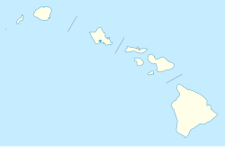
Kunia Camp, Hawaii
Kunia Camp | |
|---|---|
| Coordinates: 21°27′48″N 158°3′55″W / 21.46333°N 158.06528°W | |
| Country | United States |
| State | Hawaii |
| County | Honolulu |
| Elevation | 883 ft (269 m) |
| Time zone | UTC-10 (Hawaii-Aleutian (HAST)) |
| • Summer (DST) | UTC-9 (HADT) |
| ZIP codes | 96759 |
| GNIS feature ID | 365354 |
Kunia Camp (also called Kunia) is an unincorporated community on the island of Oahu in Honolulu County, Hawaii, United States. It lies along Hawaii Route 750 northwest of downtown Honolulu, the county seat of Honolulu County.[1] Its elevation is 883 feet (269 m).[2] It has a post office (under the name of Kunia), with the ZIP code of 96759.[3]
Government and infrastructure
[edit]The community was a plantation village for a Del Monte pineapple plantation. The plantation closed in 2006; two years later, the community's land was given to the Hawaii Agriculture Research Center, allowing its residents to keep their leases.[4] The community was added to the National Register of Historic Places in 2014.[5]
In March 2019, the Public Utilities Commission (PUC) approved 174 Power Global to build a 52 megawatt with 208 megawatt-hour storage solar farm plus battery storage project on a 352-acre site owned by Robinson Kunia Land LLC at Kunia called Hoʻohana Solar 1. HECO will buy electricity from this solar-plus-storage project at 10 cents per kilowatt-hour (kWh).[6][7] According to PUC filings, FCHQC Development, a joint venture between Forest City Sustainable Resources and 174 Power Group, owns 174 Power Group and has Larry Greene as the project manager of Hoʻohana Solar 1.[6] As of March, 2019, this project is in prime agricultural zone A land, does not have a permit for construction, and faces stiff opposition from the Hawaii Farm Bureau, the Hawaii Sierra Club, the state of Hawaii's Office of Planning, and the Hawaii State's Department of Agriculture.[6][7] Dean Okimoto and Richard Ha, two farmers who recently stopped their crop operations, said that better partnerships with farmers will allow farmers to cohabit the land so that farming melded with renewable-energy projects can boost the agricultural land's financial sustainability.[6]
References
[edit]- ^ Rand McNally. The Road Atlas '08. Chicago: Rand McNally, 2008, p. 30.
- ^ U.S. Geological Survey Geographic Names Information System: Kunia Camp, Hawaii, Geographic Names Information System, 1981-02-06. Accessed 2008-04-08.
- ^ "Zip Code Lookup".
- ^ David, Mari-Ela (May 29, 2008). "Kunia Camp Residents Welcome Plan to Preserve Plantation". Hawaii News Now. Retrieved January 20, 2015.
- ^ "Weekly List of Actions Taken on Properties: 12/01/14 Through 12/05/14". National Park Service. Retrieved January 20, 2015.
- ^ a b c d Cocke, Sophie (March 25, 2019). "Bill to put solar farms on prime ag land elicits stiff opposition". Star-Advertiser. Honolulu. Retrieved September 11, 2019.
- ^ a b Wu, Nina (March 27, 2019). "PUC approves 6 additional solar-plus-storage systems in Hawaii". Star-Advertiser. Honolulu. Retrieved September 11, 2019.
- Populated places on Oahu
- National Register of Historic Places in Honolulu County, Hawaii
- Populated places on the National Register of Historic Places
- Company towns in Hawaii
- Del Monte Foods
- Pineapple production
- Unincorporated communities in Honolulu County, Hawaii
- Western National Register of Historic Places stubs
- Hawaii geography stubs

