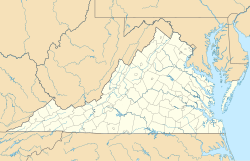
Ladd, Virginia
Appearance
This article needs additional citations for verification. (February 2014) |
Ladd, Virginia | |
|---|---|
 Aerial view of Ladd | |
| Coordinates: 38°03′21″N 78°57′12″W / 38.05583°N 78.95333°W | |
| Country | United States |
| State | Virginia |
| County | Augusta |
| Elevation | 1,411 ft (430 m) |
| Time zone | UTC-5 (Eastern (EST)) |
| • Summer (DST) | UTC-4 (EDT) |
| GNIS feature ID | 1484639[1] |
Ladd is an unincorporated community in Augusta County, Virginia, United States.[1] Ladd is located just outside the independent city of Waynesboro, Virginia and inside Augusta County. Founded in 1854, the only notable buildings of Ladd left as of 2005 are the Bethlehem Lutheran Church (built 1854), the General Store, and two homes dating to the early 1900s.
References
[edit]- ^ a b "Ladd". Geographic Names Information System. United States Geological Survey, United States Department of the Interior. Retrieved February 28, 2014.
Wikimedia Commons has media related to Ladd, Virginia.


