Lumajangdong Co
Appearance
| Lumajangdong Co | |
|---|---|
 View of lake taken during ISS Expedition 13 | |
| Coordinates | 34°00′N 81°37′E / 34.000°N 81.617°E |
| Basin countries | China |
| Surface area | 250 km2 (97 sq mi) |
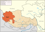
Lumajangdong Co (Tibetan: ལུ་མ་བྱང་སྟོང་མཚོ, Wylie: lu ma byang stong mtsho; Chinese: 鲁玛江东错; pinyin: Lǔmǎjiāngdōng Cuò) is a lake in the Ngari Prefecture, Tibet, China with an area of 250 km2.[1] It is located at 34° 2' 0" and 81° 40' 0".[1] Gormain lies a few miles (5–7 km) to the northwest.[2]

References
[edit]External links
[edit]

