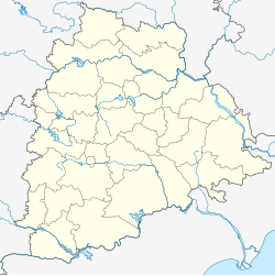
Miryalaguda
This article needs additional citations for verification. (May 2015) |
Miryalaguda | |
|---|---|
 Temple in Miryalaguda | |
| Coordinates: 16°52′00″N 79°35′00″E / 16.8667°N 79.5833°E | |
| Country | |
| State | Telangana |
| District | Nalgonda |
| Government | |
| • Type | Municipality |
| • Body | Miryalaguda Municipality |
| • MLA | Bathula Lakshma Reddy |
| Area | |
| • Total | 28.36 km2 (10.95 sq mi) |
| Population (2021)[1] | |
| • Total | 228,891 |
| • Rank | 11th in Telangana |
| • Density | 8,100/km2 (21,000/sq mi) |
| Languages | |
| • Official | Telugu |
| Time zone | UTC+5:30 (IST) |
| PIN | 508207, 508208 |
| Telephone code | +91-8689 |
| Vehicle registration | TG-05 |
| Sex ratio | 1000:995 ♂/♀ |
| Literacy | 82.09% |
| Website | miryalagudamunicipality |
Miryalaguda is a city in Nalgonda district of the Indian state of Telangana.[2] In 2015, the Government of India placed Miryalaguda under the Atal Mission for Rejuvenation and Urban Transformation scheme.[3] [4] It is located about 44 kilometres (27 mi) from the district headquarters Nalgonda, 142 kilometres (88 mi) from the state capital Hyderabad.
Geography
[edit]Miryalaguda is located at 16°52′00″N 79°35′00″E / 16.8667°N 79.5833°E.[5] It has an average elevation of 105 metres (344 ft).
Demographics
[edit]| Year | Pop. | ±% |
|---|---|---|
| 1941 | 5,628 | — |
| 1951 | 8,801 | +56.4% |
| 1961 | 10,024 | +13.9% |
| 1971 | 19,263 | +92.2% |
| 1981 | 44,129 | +129.1% |
| 1991 | 65,879 | +49.3% |
| 2001 | 91,359 | +38.7% |
| 2011 | 128,891 | +41.1% |
| Source: [6] | ||
In the 2011 Census of India, Miryalaguda had a population of 128,891.[1]
Governance
[edit]Civic Administration
[edit]Miryalaguda Municipality was constituted as a municipality in 1984 and is governed by the provisions of the Telangana State Municipalities Act, 1965 (Act). MLGM is grade-I municipality, which manages the civic services in Miryalaguda town, located in the state of Telangana (TG)
The city also Serves as headquarters of Miryalaguda mandal in the Miryalaguda revenue division
Transport
[edit]Road
[edit]State highway 2 passes through Miryalaguda as well as National Highway 167
TSRTC operates buses from Miryalaguda to various destinations in the state.

Railway
[edit]The railway station has three platforms and is situated on the Pagidipalli–Nallapadu section in Guntur Division. The track is an electrified, single line; it was electrified in 2018–19. Pagidipalli-Nallapadu was electrified in 2019. The electric trains started service on 1 September 2019.[citation needed]
Air
[edit]Rajiv Gandhi International Airport in Hyderabad is the nearest airport at a distance of 156 km by road. The other airport nearer to Miryalaguda is Vijayawada International Airport which is at a distance of 151 km by road.
See also
[edit]- Miryalaguda (Assembly constituency)
- List of cities in Telangana by area
- List of cities in Telangana by population
- List of Smart and Amrut Cities in Telangana
References
[edit]- ^ a b c "Basic Information of Municipality". Official Site of Miryalaguda Municipality.
- ^ "District Census Handbook - Nalgonda" (PDF). Census of India. p. 13. Retrieved 15 February 2016.
- ^ "AP identifies 31, Telangana 15 cities under AMRUT scheme". Eenadu English Portal.
- ^ "8 SKOCH awards for Municipal Administration dept". The Hindu English Portal. 19 June 2018.
- ^ "redirect to /world/IN/02/Mirialguda.html".
- ^ https://censusindia.gov.in/census.website/data/census-tables [bare URL]

