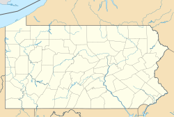
Monocacy Station, Pennsylvania
Appearance
Monocacy Station, Pennsylvania | |
|---|---|
Unincorporated community | |
| Coordinates: 40°15′42″N 75°46′02″W / 40.26167°N 75.76722°W | |
| Country | United States |
| State | Pennsylvania |
| County | Berks |
| Township | Amity |
| Elevation | 164 ft (50 m) |
| Time zone | UTC-5 (Eastern (EST)) |
| • Summer (DST) | UTC-4 (EDT) |
| ZIP Code | 19518 |
| Area code(s) | 610 and 484 |
| GNIS feature ID | 2488647[1] |
Monocacy Station is an unincorporated community that is located in Amity Township in Berks County, Pennsylvania, United States.
History and geography
[edit]This community takes its name from Monocacy Creek, which is a Native American name purported to mean "stream with several big bends".[2]
Monocacy Station is located on North Main Street to the north of the Schuylkill River and east of Birdsboro.[3] Monocacy Station previously had a post office with a ZIP code of 19542; however, this ZIP code was retired in 2016 and the community is now served by the Douglassville ZIP code of 19518.[4]
References
[edit]- ^ "Monocacy Station". Geographic Names Information System. United States Geological Survey, United States Department of the Interior.
- ^ Espenshade, Abraham Howry (1925). Pennsylvania Place Names. Evangelical Press. p. 285. ISBN 978-0-8063-0416-8.
- ^ Berks County, Pennsylvania Highway Map (PDF) (Map). PennDOT. 2015. Retrieved January 25, 2016.
- ^ Zandi, Karl (February 2016). "Geography Note: U.S. - ZIP Code Update". Moody's Analytics. Retrieved June 6, 2017.

