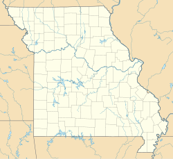
Nebo Hill Archeological Site
Nebo Hill Archeological Site | |
Archaeological Survey of Missouri No. 23-CL-11
| |
 | |
| Location | Liberty, Missouri |
|---|---|
| NRHP reference No. | 71000465[1] |
| Added to NRHP | March 4, 1971 |
Nebo Hill Archeological Site is a prominent former river bluff located in Liberty, Missouri. It has one of the highest elevations in Clay County. One source states the hill is named after the family who owned the property in the 1900s,[2] while according to another source the name is a transfer from Mount Nebo in Jordan.[3]
Archaeological findings
[edit]The hill is now a large archaeological site, with several ancient Native American artifacts having been found there. This ancient culture has been named the Nebo Hill culture.[2]
The ancient peoples lived along Fishing River, a tributary of the Missouri River. The culture flourished from 3,000 to 1,000 BCE. Their distinctive spearhead and axe designs, now known as the Nebo Hill axe, have been found as far north as Canada.[2] There have also been many pottery findings.[4] Artifacts from the Nebo Hill culture have also been found at the Renner site near Riverside, Missouri.[5]
The Nebo Hill culture is a Late Archaic culture, and it is thought to be the ancestral to the later Kansas City Hopewellian culture.[6]
Nebo Hill Point Description
[edit]The Nebo Hill point is typically a large long, thick lanceolate point with an elliptical or diamond cross section. The blade is excurvate with the widest portion of the blade being at about the mid-point. Some examples have blades that cut inward towards the base giving a slight stemmed appearance. The base varies from convex to concave and generally lacks any basal or hafting region grinding. This point is manufactured using percussion flaking with pressure flaking used to touch op the blade forming a random flaking pattern.
Geographic Distribution
[edit]This point is primarily found in northwestern Missouri prairie regions commonly found on bluffs overlooking river valleys. Found with decreased frequency outside of Missouri. This point has, very rarely, been reported into Minnesota.
Similarity to Sedalia Specimens
[edit]Sedalia share many characteristics with Nebo Hill points. However, Nebo Hill points tend to be somewhat smaller and narrower with more pressure retouch and a thick, almost diamond-shaped cross section
References
[edit]- ^ "National Register of Historic Places-Missouri(MO), Clay County". Retrieved January 25, 2010.
- ^ a b c "The Archaic Period". Fishing River. FishingRiver.com. Retrieved May 15, 2011.
- ^ "Clay County Place Names, 1928–1945 (archived)". The State Historical Society of Missouri. Archived from the original on June 24, 2016. Retrieved September 21, 2016.
{{cite web}}: CS1 maint: bot: original URL status unknown (link) - ^ "Home" (PDF). associations.missouristate.edu. Archived from the original (PDF) on July 14, 2010.
- ^ "Renner-Brenner Site Park". GaryBrenner.com. Retrieved May 15, 2011.
- ^ "KANSAS CITY HOPEWELL". Archived from the original on May 30, 2010. Retrieved January 26, 2010.
External links
[edit]- Griffin, James B.; Morse, Dan F. (April 1961). "The Short-Nosed God from the Emmons Site, Illinois". American Antiquity. 26 (4). Society for American Archaeology: 560–563. doi:10.2307/278753. JSTOR 278753. S2CID 163224869.
39°12′36″N 94°21′15″W / 39.21000°N 94.35417°W
- Archaic period in North America
- Landforms of Clay County, Missouri
- Native American history of Missouri
- Hills of the United States
- Archaeological sites on the National Register of Historic Places in Missouri
- National Register of Historic Places in Kansas City, Missouri
- Indigenous peoples of North America stubs
- Missouri stubs
- Kansas City, Missouri region Registered Historic Place stubs


