Olszyna
Appearance
Olszyna | |
|---|---|
 Town center | |
| Coordinates: 51°4′0″N 15°23′20″E / 51.06667°N 15.38889°E | |
| Country | |
| Voivodeship | Lower Silesian |
| County | Lubań |
| Gmina | Olszyna |
| Town rights | 2005 |
| Area | |
• Total | 20.26 km2 (7.82 sq mi) |
| Population (2019-06-30[1]) | |
• Total | 4,348 |
| • Density | 210/km2 (560/sq mi) |
| Time zone | UTC+1 (CET) |
| • Summer (DST) | UTC+2 (CEST) |
| Postal code | 59-830 |
| Area code | +48 75 |
| License plates | DLB |
| Website | http://www.olszyna.pl |
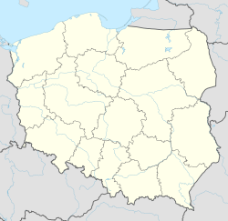
Olszyna [ɔlˈʂɨna] (German: Langenöls) is a town in Lubań County, Lower Silesian Voivodeship, in south-western Poland. Its name means "alder wood" in Polish. It is the seat of the administrative district (gmina) called Gmina Olszyna. A settlement dating back to the Middle Ages, it received its town charter in 2005.
It lies approximately 9 kilometres (6 mi) south-east of Lubań, and 116 kilometres (72 mi) west of the regional capital Wrocław. As of 2019, the town has a population of 4,348.
References
[edit]- ^ "Population. Size and structure and vital statistics in Poland by territorial division in 2019. As of 30th June". stat.gov.pl. Statistics Poland. 2019-10-15. Retrieved 2020-02-14.
External links
[edit]


