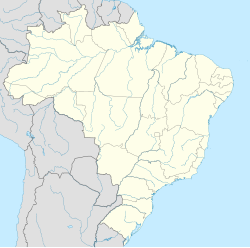
Pampulha (Belo Horizonte)
Pampulha | |
|---|---|
Administrative Region | |
| |
Aerial view of Pampulha | |
 Location of Pampulha in Belo Horizonte | |
| Coordinates: 19°51′44″S 43°58′14″W / 19.86222°S 43.97056°W | |
| Country | |
| Region | Southeast |
| State | |
| City | |
| Founded | 1943 |
| Area | |
• Total | 47.13 km2 (18.20 sq mi) |
| Population (2015) | |
• Total | 145,262 |
| • Density | 3.08/km2 (8.0/sq mi) |
| Time zone | UTC-3 (Brasilia Official Time) |
| • Summer (DST) | UTC-2 (Brazilian Daylight Saving Time) |
Pampulha (Portuguese: Região Administrativa da Pampulha) is an administrative region in the city of Belo Horizonte, Brazil. It is one of nine administrative regions of Belo Horizonte, and occupies 47.13 kilometres (29.29 mi) in the northeast of the city. It has a population of 145,262 and a population density of 3.08 per square kilometer. The center of the Pampulha is occupied by Lake Pampulha, an artificial lake constructed in the early 1940s by Mayor Juscelino Kubitschek, later president of Brazil from 1956 to 1961. The Pampulha administrative region is further subdivided into 29 neighborhoods (bairros), one of which is also called Pampulha.[1][2]
Otacílio Negrão de Lima, mayor of Belo Horizonte in the early 20th century, dammed a small stream called Pampulha in 1936 for flood control and augment the city water supply through the creation of a reservoir. The resulting Lake Pampulha became the site of an urban development project by Juscelino Kubitschek. Kubitschek called on the young architect Oscar Niemeyer to create a series of buildings; Niemeyer was joined by the landscape architect Roberto Burle Marx and numerous artists to create site now considered the earliest and most important example of Modernism in Brazil.[1][3]
In July 2016 the area around the lake became an UNESCO World Heritage Site known as the Pampulha Modern Ensemble (Conjunto Arquitetônico da Pampulha).[3][4]
Transport
[edit]Belo Horizonte/Pampulha – Carlos Drummond de Andrade Airport is in the area.
Education
[edit]This section needs expansion. You can help by adding to it. (February 2017) |
The Santa Amélia section formerly housed the Escola Japonesa de Belo Horizonte (ベロ・オリゾンテ日本人学校) a.k.a. Instituto Cultural Mokuyoo-Kai Sociedade Civil, a Japanese day school.[5][6]
References
[edit]- ^ a b "Perfil da Região Administrativa Pampulha" (in Portuguese). Belo Horizonte, MG: Prefeitura Municipal de Belo Horizonte. 2003. Archived from the original on 2016-08-13. Retrieved 2016-07-16.
- ^ "IBGE divulga dados populacionais de Belo Horizonte" (in Portuguese). Belo Horizonte, MG: Prefeitura Municipal de Belo Horizonte. 2011-05-08. Archived from the original on 2013-11-06. Retrieved 2016-07-16.
- ^ a b "Candidatura da Pampulha a patrimônio mundial será oficializada" (in Portuguese). UNESCO. 2014-10-12. Retrieved 2016-07-16.
- ^ "Four new sites inscribed on UNESCO's World Heritage List". UNESCO. 2016-07-17. Retrieved 2016-07-20.
- ^ Home page. Escola Japonesa de Belo Horizonte. Retrieved on January 15, 2015.
- ^ "中南米の日本人学校一覧" (Archive). National Education Center, Japan (国立教育会館). October 3, 1999. Retrieved on February 16, 2015. "Instituto Cultural Mokuyoo-Kai Sociedade Civil Rua das Canarias,2171 Santa Amelia, Belo Horizonte, M.G, Brasil"
