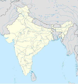
Patuli
Patuli | |
|---|---|
Village | |
| Coordinates: 23°34′07″N 88°17′16″E / 23.5686°N 88.2877°E | |
| Country | |
| State | West Bengal |
| District | Purba Bardhaman |
| Elevation | 18 m (59 ft) |
| Population (2011) | |
• Total | 4,681 |
| Languages | |
| • Official | Bengali, English |
| Time zone | UTC+5:30 (IST) |
| PIN | 713512 |
| Vehicle registration | WB |
| Website | purbabardhaman |
Patuli is a village under Purbasthali police station[1] of Kalna subdivision in Purba Bardhaman district in the Indian state of West Bengal.
History
[edit]Patuli was the centre of an old Hindu kingdom, which fell to the advancing Turkish forces.[2] Subsequently, Lord Clive passed through Patuli and Katwa with his forces on his way to Palashi in 1757.[3]
Geography
[edit]
5miles
M: municipal city/ town, CT: census town, R: rural/ urban centre, H: historical/ religious centre, C: craft centre.
Owing to space constraints in the small map, the actual locations in a larger map may vary slightly
Location
[edit]Patuli is located at 23°34′07″N 88°17′16″E / 23.5686°N 88.2877°E.[4] It has an average elevation of 18 metres (59 feet).
Patuli is located between the Bhagirathi, Ajay and Damodar rivers.[5] Temperatures in this region vary from 17-18 °C in winter to 30-32 °C in summer.[6]
CD block HQ
[edit]The headquarters of Purbasthali II CD block are located at Patuli.[7][8]
Urbanisation
[edit]87.00% of the population of Kalna subdivision live in the rural areas. Only 13.00% of the population live in the urban areas.[9] The map alongside presents some of the notable locations in the subdivision. All places marked in the map are linked in the larger full screen map.
Demographics
[edit]As per the 2011 Census of India, Patuli had a total population of 4,681 of which 2,391 (51%) were males and 2,290 (49%) were females. Population below 6 years was 389. The total number of literates in Patuli was 3,235 (75.37% of the population over 6 years).[10]
As of 2001[update] India census,[11] Patuli had a population of 4,451. Males constitute 51% of the population and females 49%. Patuli has an average literacy rate of 64%, higher than the national average of 59.5%: male literacy is 69%, and female literacy is 60%. In Patuli, 10% of the population is under 6 years of age.
Economy
[edit]About 32,00,000 people commute daily from around the city to Kolkata. Thirty-eight trains transport commuters from 45 stations in the Howrah-Katwa section.[12]
Transport
[edit]Patuli railway station is 127 km from Howrah on the Bandel-Katwa Branch Line.[13]
Education
[edit]In olden days Patuli had traditional Sanskrit tol.[14] The name of Patuli High School is present in the survey of schools made in 1909-10. This was established by Gour Mohon Bhattacharjee, a graduate from the then Duff College (later Scottish Church College). Gour Mohan Bhattacharjee, the founder-headmaster of Patuli High School was a student of M.A.(Botany) at the University of Calcutta. He could however, not complete the course due to a conflict with an English professor. During his time, M.Sc. courses had not been introduced by the university, and all subjects were grouped under the arts.[15]
Patuli has two primary, one secondary and one higher secondary schools.[16]
Healthcare
[edit]There is a primary health centre at Patuli (with 10 beds).[17]
References
[edit]- ^ District-wise list of stautory towns Archived 2007-09-30 at the Wayback Machine
- ^ Chattopadhyay, Akkori, p. 170
- ^ Chattopadhyay, Akkori, p. 209
- ^ Falling Rain Genomics, Inc - Patuli
- ^ Chattopadhyay, Akkori, Bardhaman Jelar Itihas O Lok Sanskriti (History and Folk lore of Bardhaman District.), (in Bengali) , Vol I, p. 15, Radical Impression. ISBN 81-85459-36-3
- ^ Chattopadhyay, Akkori, p. 19
- ^ "District Census Handbook: Barddhaman" (PDF). Map of Barddhaman with CD Block HQs and Police Stations (on the fourth page). Directorate of Census Operations, West Bengal, 2011. Retrieved 17 March 2017.
- ^ "BDO Offices under Burdwan District". Department of Mass Education Extension & Library Services, Government of West Bengal. West Bengal Public Library Network. Archived from the original on 5 October 2018. Retrieved 8 February 2019.
- ^ "District Statistical Handbook 2014 Bardhaman". Table 2.2. Department of Statistics and Programme Implementation, Government of West Bengal. Archived from the original on 21 January 2019. Retrieved 25 January 2019.
- ^ "C.D. Block Wise Primary Census Abstract Data(PCA)". 2011 census: West Bengal – District-wise CD Blocks. Registrar General and Census Commissioner, India. Retrieved 21 January 2019.
- ^ "Census of India 2001: Data from the 2001 Census, including cities, villages and towns (Provisional)". Census Commission of India. Archived from the original on 16 June 2004. Retrieved 1 November 2008.
- ^ Dey, Teesta. "The Suburban Railway Network of Kolkata: A Geographical Apprisal" (PDF). eTraverse, the Indian journal of spatial science, 2012. Archived from the original (PDF) on 18 November 2017. Retrieved 23 February 2019.
- ^ Railway local time table
- ^ Chattopadhyay, Akkori, p. 546
- ^ Chattopadhyay, Akkori, p. 554
- ^ 7th All-India School Education Survey 2003 Archived 2007-09-27 at the Wayback Machine
- ^ "Health & Family Welfare Department". Health Statistics. Government of West Bengal. Retrieved 19 January 2019.


